Harrison Township, Howard County, Indiana
| Harrison Township | |
|---|---|
| Township | |
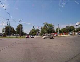 Intersection of Highway 931 and Highway 26 in Harrison Township | |
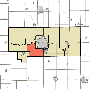 Location in Howard County | |
| Coordinates: 40°26′13″N 86°11′13″W / 40.43694°N 86.18694°WCoordinates: 40°26′13″N 86°11′13″W / 40.43694°N 86.18694°W | |
| Country | United States |
| State | Indiana |
| County | Howard |
| Government | |
| • Type | Indiana township |
| Area | |
| • Total | 21.77 sq mi (56.4 km2) |
| • Land | 21.68 sq mi (56.2 km2) |
| • Water | 0.09 sq mi (0.2 km2) 0.41% |
| Elevation | 833 ft (254 m) |
| Population (2010) | |
| • Total | 9,489 |
| • Estimate (2012[1]) | 9,518 |
| • Density | 437.8/sq mi (169.0/km2) |
| GNIS feature ID | 0453389 |
Harrison Township is one of 11 townships in Howard County, Indiana, United States. As of the 2010 census, its population was 9,489 and it contained 4,169 housing units.[2]
Geography
| Historical population | |||
|---|---|---|---|
| Census | Pop. | %± | |
| 2000 | 8,498 | — | |
| 2010 | 9,489 | 11.7% | |
| Est. 2012 | 9,518 | 0.3% | |
| U.S. Census[3] | |||
According to the 2010 census, the township has a total area of 21.77 square miles (56.4 km2), of which 21.68 square miles (56.2 km2) (or 99.59%) is land and 0.09 square miles (0.23 km2) (or 0.41%) is water.[2] Harrison Township was also one of the only townships in Howard County to grow from 2000 to 2010.
Cities and towns
- Kokomo (southwest edge)
Unincorporated towns
Former Settlements
- Alto (annexed into Kokomo in 2012)
- Tarkington
Adjacent townships
- Clay Township (north)
- Center Township (northeast)
- Taylor Township (east)
- Liberty Township, Tipton County (southeast)
- Prairie Township, Tipton County (south)
- Honey Creek Township (west)
- Monroe Township (west)
Cemeteries
The township contains two cemeteries: Sunset Memory Gardens and Twin Spring.
Major highways
Airports and landing strips
- Glenndale Airport
- Ruzicka Airport
Recreation
Golf Courses
- Chipendale Golf Course, located a mile south of SR 26 on Park Road.
- Rice's Golf Center, located on US 31 at Center Road.
- Wildcat Creek Golf Course, located in Timbervalley subdivision, entrances on Center Road and SR 26.
Parks
- Jackson-Morrow Park, entrances located on Park Road between Alto and Center roads as well as on Webster Street.
Schools
Post Offices
- West Middleton Post Office, located at the corner of Alto Road and Rabbit Street.
- Kokomo Main Post Office, located at the corner of Webster Street and Lincoln Road.
Businesses
Hotels/Bed & Breakfasts
- Bavarian Inn Bed & Breakfast, (NWC) Dixon and Center roads
Food
- Bavarian Inn Bed & Breakfast, (NWC) Dixon and Center roads
- Cone Palace, (SWC) Center Road and US 31
- Culver's, (SWC) Pipeline Way and US 31
- Golden Corral, (NWC) Center Road and US 31
- Grindstone Charley's, located between LaFountain Street and US 31
- Half Moon Restaurant and Brewery, (NWC) Pipeline Way and US 31
- IHOP, (NWC) Center Road and US 31
- Marsh Supermarket, (NWC) LaFountain Street and Southway Boulevard
- Mike's Pizza, (SWC) Dixon and Alto roads
- Olive Garden, (SWC) LaFountain Street and Haynes Mall Boulevard
- Ruby Tuesday, (SWC) Southway Boulevard and US 31
- Steak 'n Shake, (NWC) Southway Boulevard and US 31 (near Hospital)
- Taco Bell, located between LaFountain Street and US 31
- White's Meat Market, (NWC) SR 26 and US 31
Gas
- Marsh Gas, (NWC) LaFountain Street and Southway Boulevard
- The Alto Express Phillips 66, (NWC) Dixon and Alto roads
- Shell Oil Company, (SWC) Center Road and US 31
- Speedway, (NEC) Dixon and Alto roads
- SuperTest, (NWC) LaFountain Street and Southway Boulevard
Pharmacies
- Marsh Supermarket, (NWC) LaFountain Street and Southway Boulevard
- Walgreens, (NEC) LaFountain Street and Southway Boulevard
Public Safety
- Harrison Township Volunteer Fire Department, 4102 S. Dixon Road
References
- "Harrison Township, Howard County, Indiana". Geographic Names Information System. United States Geological Survey. Retrieved 2009-09-24.
- United States Census Bureau cartographic boundary files
- ↑ "Population Estimates". United States Census Bureau. Retrieved 2013-06-25.
- 1 2 "Population, Housing Units, Area, and Density: 2010 - County -- County Subdivision and Place -- 2010 Census Summary File 1". United States Census. Retrieved 2013-05-10.
- ↑ "US Census Data". US Government Census Agency. Archived from the original on 8 October 2014. Retrieved 26 February 2014.
External links
Municipalities and communities of Howard County, Indiana, United States | ||
|---|---|---|
| City | ||
| Towns | ||
| Townships | ||
| Other unincorporated communities | ||
This article is issued from
Wikipedia.
The text is licensed under Creative Commons - Attribution - Sharealike.
Additional terms may apply for the media files.