Harper, Kansas
| Harper, Kansas | |
|---|---|
| City | |
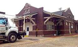 Harper Train Depot (2015) | |
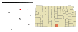 Location within Harper County and Kansas | |
 KDOT map of Harper County (legend) | |
| Coordinates: 37°17′7″N 98°1′36″W / 37.28528°N 98.02667°WCoordinates: 37°17′7″N 98°1′36″W / 37.28528°N 98.02667°W | |
| Country | United States |
| State | Kansas |
| County | Harper |
| Government | |
| • Mayor | Rory L. Pugh |
| • City Clerk | Tanya Wilson |
| Area[1] | |
| • Total | 1.63 sq mi (4.22 km2) |
| • Land | 1.63 sq mi (4.22 km2) |
| • Water | 0 sq mi (0 km2) |
| Elevation | 1,417 ft (432 m) |
| Population (2010)[2] | |
| • Total | 1,473 |
| • Estimate (2016)[3] | 1,376 |
| • Density | 900/sq mi (350/km2) |
| Time zone | UTC-6 (CST) |
| • Summer (DST) | UTC-5 (CDT) |
| ZIP code | 67058 |
| Area code | 620 |
| FIPS code | 20-30175 [4] |
| GNIS ID | 0470467 [5] |
| Website | CityOfHarper.com |
Harper is a city in Harper County, Kansas, United States. As of the 2010 census, the city population was 1,473.[6]
History
Harper was founded in 1877 by a colony from Iowa.[7] The city of Harper, like Harper County, is named for Sergeant Marion Harper of the 2nd Kansas Cavalry, who fell in the (American) Civil War.[8] Harper was incorporated as a city in 1880.[9]
The first post office in Harper was established in May 1877 as Cora City, but in June of that year, the post office was renamed Harper.[10]
Geography
Harper is located at 37°17′07″N 98°01′36″W / 37.285252°N 98.026615°W (37.285252, -98.026615).[11] According to the United States Census Bureau, the city has a total area of 1.63 square miles (4.22 km2), all of it land.[1]
Demographics
| Historical population | |||
|---|---|---|---|
| Census | Pop. | %± | |
| 1890 | 1,579 | — | |
| 1900 | 1,151 | −27.1% | |
| 1910 | 1,638 | 42.3% | |
| 1920 | 1,770 | 8.1% | |
| 1930 | 1,485 | −16.1% | |
| 1940 | 1,695 | 14.1% | |
| 1950 | 1,672 | −1.4% | |
| 1960 | 1,899 | 13.6% | |
| 1970 | 1,665 | −12.3% | |
| 1980 | 1,823 | 9.5% | |
| 1990 | 1,735 | −4.8% | |
| 2000 | 1,567 | −9.7% | |
| 2010 | 1,473 | −6.0% | |
| Est. 2016 | 1,376 | [3] | −6.6% |
| U.S. Decennial Census | |||
2010 census
As of the census[2] of 2010, there were 1,473 people, 624 households, and 385 families residing in the city. The population density was 903.7 inhabitants per square mile (348.9/km2). There were 742 housing units at an average density of 455.2 per square mile (175.8/km2). The racial makeup of the city was 92.2% White, 0.2% African American, 1.3% Native American, 0.1% Asian, 0.5% Pacific Islander, 4.8% from other races, and 1.0% from two or more races. Hispanic or Latino of any race were 10.0% of the population.
There were 624 households of which 30.9% had children under the age of 18 living with them, 47.0% were married couples living together, 8.7% had a female householder with no husband present, 6.1% had a male householder with no wife present, and 38.3% were non-families. 34.5% of all households were made up of individuals and 15.4% had someone living alone who was 65 years of age or older. The average household size was 2.33 and the average family size was 2.95.
The median age in the city was 40.3 years. 25.1% of residents were under the age of 18; 8% were between the ages of 18 and 24; 22.8% were from 25 to 44; 25.1% were from 45 to 64; and 19.1% were 65 years of age or older. The gender makeup of the city was 50.2% male and 49.8% female.
2000 census
As of the census[4] of 2000, there were 1,567 people, 675 households, and 417 families residing in the city. The population density was 1,219.0 people per square mile (469.0/km2). There were 787 housing units at an average density of 612.2 per square mile (235.6/km2). The racial makeup of the city was 97.57% White, 0.13% African American, 0.64% Native American, 0.57% from other races, and 1.08% from two or more races. Hispanic or Latino of any race were 1.21% of the population.
There were 675 households out of which 28.0% had children under the age of 18 living with them, 51.3% were married couples living together, 8.7% had a female householder with no husband present, and 38.2% were non-families. 35.3% of all households were made up of individuals and 18.1% had someone living alone who was 65 years of age or older. The average household size was 2.29 and the average family size was 2.98.
In the city, the population was spread out with 26.0% under the age of 18, 6.4% from 18 to 24, 22.0% from 25 to 44, 23.9% from 45 to 64, and 21.7% who were 65 years of age or older. The median age was 42 years. For every 100 females, there were 93.5 males. For every 100 females age 18 and over, there were 93.2 males.
The median income for a household in the city was $30,272, and the median income for a family was $40,761. Males had a median income of $29,583 versus $19,779 for females. The per capita income for the city was $16,543. About 6.9% of families and 9.5% of the population were below the poverty line, including 11.0% of those under age 18 and 6.4% of those age 65 or over.
Education
Anthony is served by USD 361 Anthony-Harper.[12] USD 361 was created through school unification that consolidated Anthony and Harper schools.
Both Anthony and Harper have elementary schools. The district high school, Chaparral High School, is located halfway between the two towns. The Chaparral High School mascot is Roadrunners.[13]
Harper High School was closed through school unification. The Harper High School mascot was Bearcats.[14]
Cultural references
An episode on the NBC sitcom Veronica's Closet which aired from 1997 to 2000 called Veronica's Big Homecoming was about Harper .
References
- 1 2 "US Gazetteer files 2010". United States Census Bureau. Retrieved 2012-07-06.
- 1 2 "American FactFinder". United States Census Bureau. Retrieved 2012-07-06.
- 1 2 "Population and Housing Unit Estimates". Retrieved June 9, 2017.
- 1 2 "American FactFinder". United States Census Bureau. Retrieved 2008-01-31.
- ↑ "US Board on Geographic Names". United States Geological Survey. 2007-10-25. Retrieved 2008-01-31.
- ↑ "2010 City Population and Housing Occupancy Status". U.S. Census Bureau. Retrieved March 6, 2011.
- ↑ Blackmar, Frank Wilson (1912). Kansas: A Cyclopedia of State History, Embracing Events, Institutions, Industries, Counties, Cities, Towns, Prominent Persons, Etc. Standard Publishing Company. p. 809.
- ↑ "Profile for Harper, Kansas". ePodunk. Retrieved 11 June 2014.
- ↑ History of the State of Kansas: Containing a Full Account of Its Growth from an Uninhabited Territory to a Wealthy and Important State. A. T. Andreas. 1883. p. 366.
- ↑ "Kansas Post Offices, 1828-1961 (archived)". Kansas Historical Society. Archived from the original on October 9, 2013. Retrieved 11 June 2014.
- ↑ "US Gazetteer files: 2010, 2000, and 1990". United States Census Bureau. 2011-02-12. Retrieved 2011-04-23.
- ↑ "Anthony-Harper". USD 361. Retrieved 7 January 2017.
- ↑ "Anthony-Harper". USD 361. Retrieved 4 January 2017.
- ↑ "Bucklin and Harper Are Both Victorious", Great Bend Tribune, 3 March 1965, p.13.
External links
| Wikimedia Commons has media related to Harper, Kansas. |
- City
- Schools
- USD 361, local school district
- Maps
- Harper City Map, KDOT
Municipalities and communities of Harper County, Kansas, United States | ||
|---|---|---|
| Cities |  | |
| Unincorporated communities | ||
| Townships | ||
| Ghost town | ||