Harich, Armenia
Coordinates: 40°35′53″N 44°00′27″E / 40.59806°N 44.00750°E
| Harich Հառիճ | |
|---|---|
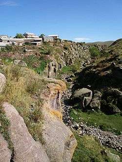 The village of Harich and the gorge below as seen from Harichavank. | |
 Harich Հառիճ | |
| Coordinates: 40°35′53″N 44°00′27″E / 40.59806°N 44.00750°E | |
| Country | Armenia |
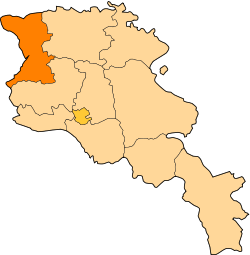
| Marz (Province) | Shirak |
| Government | |
| • Mayor | ? |
| Area | |
| • Total | 1.08 km2 (0.42 sq mi) |
| Population (2008) | |
| • Total | 1,069 |
| Time zone | UTC+4 ( ) |
| • Summer (DST) | UTC+5 ( ) |
Harich (Armenian: Հառիճ; also Romanized as Harrich and Arich) is a village in the Shirak Province of Armenia. Within the village is the Harichavank Monastery of the 8th century. Across the gorge from the monastery is a 3rd millennium BC fortress and tomb field.
Population
Population per years is the following.[1]
| Year | 1831 | 1887 | 1926 | 1939 | 1959 | 1970 | 1979 | 2001 | 2004 |
|---|---|---|---|---|---|---|---|---|---|
| Pop. | 86 | 654 | 880 | 1035 | 1958 | 1096 | 1058 | 1123 | 1427 |
Gallery
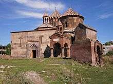 Rear view of 7th century Harichavank Monastery
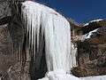 Frozen waterfalls
 Field in Harich
References
- ↑ "Dictionary of Armenian residences (Հայաստանի հանրապետության բնակավայրերի բառարան), page 119" (PDF). Retrieved April 18, 2014.
- Harich, Armenia at GEOnet Names Server
- World Gazeteer: Armenia – World-Gazetteer.com
- Report of the results of the 2001 Armenian Census, National Statistical Service of the Republic of Armenia
- Kiesling, Brady (2005), Rediscovering Armenia: Guide, Yerevan, Armenia: Matit Graphic Design Studio
- Brady Kiesling, Rediscovering Armenia, p. 77; original archived at Archive.org, and current version online on Armeniapedia.org.
This article is issued from
Wikipedia.
The text is licensed under Creative Commons - Attribution - Sharealike.
Additional terms may apply for the media files.