Hanover Saugeen Airport
| Saugeen Municipal Airport Hanover Saugeen Airport | |||||||||||||||
|---|---|---|---|---|---|---|---|---|---|---|---|---|---|---|---|
 | |||||||||||||||
| Summary | |||||||||||||||
| Airport type | Public | ||||||||||||||
| Operator | Municipality of Brockton, Town of Hanover, Municipality of West Grey | ||||||||||||||
| Serves | Municipality of Brockton, Town of Hanover, Municipality of West Grey | ||||||||||||||
| Location | Hanover, Ontario | ||||||||||||||
| Time zone | EST (UTC−05:00) | ||||||||||||||
| • Summer (DST) | EDT (UTC−04:00) | ||||||||||||||
| Elevation AMSL | 940 ft / 287 m | ||||||||||||||
| Coordinates | 44°09′29″N 081°03′48″W / 44.15806°N 81.06333°WCoordinates: 44°09′29″N 081°03′48″W / 44.15806°N 81.06333°W | ||||||||||||||
| Website | www.saugeenmunicipalairport.com | ||||||||||||||
| Map | |||||||||||||||
 CYHS Location in Ontario  CYHS CYHS (Canada) | |||||||||||||||
| Runways | |||||||||||||||
| |||||||||||||||
|
Source: Canada Flight Supplement[1] | |||||||||||||||
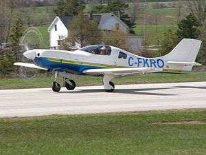
Hanover Saugeen Airport (ICAO: CYHS) is located 1.6 nautical miles (3.0 km; 1.8 mi) west northwest[1] of Hanover, Ontario, Canada.
The airport is classified as an airport of entry by Nav Canada and is staffed by the Canada Border Services Agency (CBSA). CBSA officers at this airport can handle general aviation aircraft only, with no more than 15 passengers.[1]
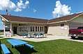 Terminal Building
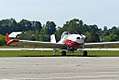 Thrush Ag Spray
 1949 Stinson 108
References
- 1 2 3 Canada Flight Supplement. Effective 0901Z 19 July 2018 to 0901Z 13 September 2018.
External links
- Website for Saugeen Municipal Airport
- Page about this airport on COPA's Places to Fly airport directory
| By name | |
|---|---|
| By location indicator | |
| By province/territory | |
| By area | |
| National Airports System | |
| Related | |
| |
This article is issued from
Wikipedia.
The text is licensed under Creative Commons - Attribution - Sharealike.
Additional terms may apply for the media files.