Hall Township, Bureau County, Illinois
| Hall Township | |
|---|---|
| Township | |
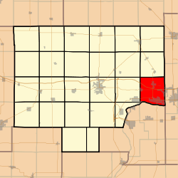 Location in Bureau County | |
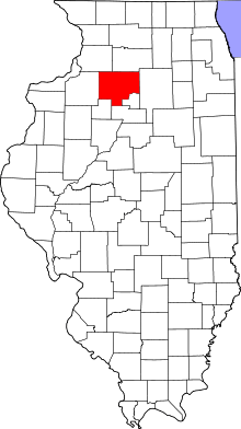 Bureau County's location in Illinois | |
| Coordinates: 41°22′01″N 89°13′02″W / 41.36694°N 89.21722°WCoordinates: 41°22′01″N 89°13′02″W / 41.36694°N 89.21722°W | |
| Country | United States |
| State | Illinois |
| County | Bureau |
| Established | November 6, 1849 |
| Area | |
| • Total | 37.88 sq mi (98.1 km2) |
| • Land | 37.22 sq mi (96.4 km2) |
| • Water | 0.67 sq mi (1.7 km2) 1.77% |
| Elevation | 659 ft (201 m) |
| Population (2010) | |
| • Estimate (2016)[1] | 7,869 |
| • Density | 223/sq mi (86/km2) |
| Time zone | UTC-6 (CST) |
| • Summer (DST) | UTC-5 (CDT) |
| ZIP codes | 61312, 61320, 61322, 61329, 61354, 61356, 61359, 61362 |
| FIPS code | 17-011-32265 |
Hall Township is one of twenty-five townships in Bureau County, Illinois, USA. As of the 2010 census, its population was 8,300 and it contained 3,692 housing units.[2] Hall Township changed its name from Bloom Township in June, 1850.
Geography
According to the 2010 census, the township has a total area of 37.88 square miles (98.1 km2), of which 37.22 square miles (96.4 km2) (or 98.26%) is land and 0.67 square miles (1.7 km2) (or 1.77%) is water.[2]
Cities
- Dalzell (vast majority)
- De Pue (east edge)
- Ladd
- Seatonville (east three-quarters)
- Spring Valley
Unincorporated towns
(This list is based on USGS data and may include former settlements.)
Cemeteries
The township contains these eleven cemeteries: Ladd, Lithuanian, Miller, Mount Olivet Catholic, Ottville, Saint Annes Catholic, Saint George Syrian, Saint Josephs, Saint Valentines, Saints Peter and Paul and Valley Memorial Park.
Major highways
Airports and landing strips
- Saint Margarets Hospital Heliport
- Valley Airfield
Rivers
Landmarks
- Kirby Park
Demographics
| Historical population | |||
|---|---|---|---|
| Census | Pop. | %± | |
| Est. 2016 | 7,869 | [1] | |
| U.S. Decennial Census[3] | |||
Political districts
- Illinois' 11th congressional district
- Spring Valley and part of Dalzell are in Illinois' 18th congressional district
- State House District 76
- State Senate District 38
References
- "Hall Township, Bureau County, Illinois". Geographic Names Information System. United States Geological Survey. Retrieved 2010-01-04.
- United States Census Bureau 2007 TIGER/Line Shapefiles
- United States National Atlas
- 1 2 "Population and Housing Unit Estimates". Retrieved June 9, 2017.
- 1 2 "Population, Housing Units, Area, and Density: 2010 - County -- County Subdivision and Place -- 2010 Census Summary File 1". United States Census. Retrieved 2013-05-28.
- ↑ "Census of Population and Housing". Census.gov. Retrieved June 4, 2016.
External links
Places adjacent to Hall Township, Bureau County, Illinois | |
|---|---|
Municipalities and communities of Bureau County, Illinois, United States | ||
|---|---|---|
| Cities | ||
| Villages | ||
| Townships | ||
| Unincorporated communities | ||
| Ghost town | ||
| Footnotes | ‡This populated place also has portions in an adjacent county or counties | |
This article is issued from
Wikipedia.
The text is licensed under Creative Commons - Attribution - Sharealike.
Additional terms may apply for the media files.