Arispie Township, Bureau County, Illinois
| Arispie Township | |
|---|---|
| Township | |
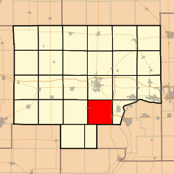 Location in Bureau County | |
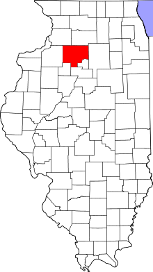 Bureau County's location in Illinois | |
| Coordinates: 41°16′33″N 89°27′05″W / 41.27583°N 89.45139°WCoordinates: 41°16′33″N 89°27′05″W / 41.27583°N 89.45139°W | |
| Country | United States |
| State | Illinois |
| County | Bureau |
| Established | November 6, 1849 |
| Area | |
| • Total | 36.43 sq mi (94.4 km2) |
| • Land | 36.27 sq mi (93.9 km2) |
| • Water | 0.16 sq mi (0.4 km2) 0.44% |
| Elevation | 653 ft (199 m) |
| Population (2010) | |
| • Estimate (2016)[1] | 735 |
| • Density | 21.4/sq mi (8.3/km2) |
| Time zone | UTC-6 (CST) |
| • Summer (DST) | UTC-5 (CDT) |
| ZIP codes | 61356, 61368 |
| FIPS code | 17-011-02076 |
Arispie Township is one of twenty-five townships in Bureau County, Illinois, USA. As of the 2010 census, its population was 776 and it contained 371 housing units.[2]
Geography
According to the 2010 census, the township has a total area of 36.43 square miles (94.4 km2), of which 36.27 square miles (93.9 km2) (or 99.56%) is land and 0.16 square miles (0.41 km2) (or 0.44%) is water.[2]
Cities
- Tiskilwa (east half)
Major highways
Lakes
- Goose Lake
Demographics
| Historical population | |||
|---|---|---|---|
| Census | Pop. | %± | |
| Est. 2016 | 735 | [1] | |
| U.S. Decennial Census[3] | |||
Political districts
- Illinois' 11th congressional district
- State House District 73
- State Senate District 37
References
- "Arispie Township, Bureau County, Illinois". Geographic Names Information System. United States Geological Survey. Retrieved 2010-01-04.
- United States Census Bureau 2007 TIGER/Line Shapefiles
- United States National Atlas
- 1 2 "Population and Housing Unit Estimates". Retrieved June 9, 2017.
- 1 2 "Population, Housing Units, Area, and Density: 2010 - County -- County Subdivision and Place -- 2010 Census Summary File 1". United States Census. Retrieved 2013-05-28.
- ↑ "Census of Population and Housing". Census.gov. Retrieved June 4, 2016.
External links
Places adjacent to Arispie Township, Bureau County, Illinois | |
|---|---|
Municipalities and communities of Bureau County, Illinois, United States | ||
|---|---|---|
| Cities | ||
| Villages | ||
| Townships | ||
| Unincorporated communities | ||
| Ghost town | ||
| Footnotes | ‡This populated place also has portions in an adjacent county or counties | |
This article is issued from
Wikipedia.
The text is licensed under Creative Commons - Attribution - Sharealike.
Additional terms may apply for the media files.