Hajdúböszörmény District
| Hajdúböszörmény District Hajdúböszörményi járás | ||
|---|---|---|
| Districts of Hungary | ||
| ||
 Hajdúböszörmény District within Hungary and Hajdú-Bihar County. | ||
| Country |
| |
| County | Hajdú-Bihar | |
| District seat | Hajdúböszörmény | |
| Area | ||
| • Total | 471.43 km2 (182.02 sq mi) | |
| Area rank | 9th in Hajdú-Bihar | |
| Population (2011 census) | ||
| • Total | 40,568 | |
| • Rank | 5th in Hajdú-Bihar | |
| • Density | 86/km2 (220/sq mi) | |
Hajdúböszörmény (Hungarian: Hajdúböszörményi járás) is a district in northern part of Hajdú-Bihar County. Hajdúböszörmény is also the name of the town where the district seat is found. The district is located in the Northern Great Plain Statistical Region. This district is a part of Hajdúság historical and geographical region.
Geography
Hajdúböszörmény District borders with Tiszavasvári District and Nyíregyháza District (Szabolcs-Szatmár-Bereg County) to the north, Hajdúhadház District to the east, Debrecen District to the south, Balmazújváros District and Hajdúnánás District to the west. The number of the inhabited places in Hajdúböszörmény District is 2.
Municipalities
The district has 2 towns. (ordered by population, as of 1 January 2012)[1]
- Hajdúböszörmény (31,306) – district seat
- Hajdúdorog (8,888)
The bolded municipalities are cities.
Demographics
Religion in Hajdúböszörmény District (2011 census)
In 2011, it had a population of 40,568 and the population density was 86/km².
| Year | County population[2] | Change |
|---|---|---|
| 2011 | 40,568 | n/a |
Ethnicity
Besides the Hungarian majority, the main minorities are the Roma (approx. 1,000) and German (100).
Total population (2011 census): 40,568
Ethnic groups (2011 census):[3] Identified themselves: 36,078 persons:
- Hungarians: 34,741 (96.29%)
- Gypsies: 973 (2.70%)
- Others and indefinable: 364 (1.01%)
Approx. 4,500 persons in Hajdúböszörmény District did not declare their ethnic group at the 2011 census.
Religion
Religious adherence in the county according to 2011 census:[4]
- Reformed – 8,822;
- Catholic – 8,779 (Greek Catholic – 7,087; Roman Catholic – 1,692);
- other religions – 846;
- Non-religious – 11,548;
- Atheism – 445;
- Undeclared – 10,128.
Gallery
 Hajdúböszörmény, the headquarters of Hajdú District
 View of Hajdúdorog
 Bocskai Square (Hajdúböszörmény)
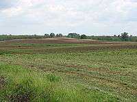 "Highest" point (Debeje-halom) of Hajdúdorog
 Greek Catholic Cathedral in Hajdúdorog
 Remains of the fortified Cathedral' wall in Hajdúdorog
See also
References
- ↑ A KSH 2012. évi helységnévkönyve
- ↑ népesség.com, "Hajdúböszörményi járás népessége"
- ↑ 4.1.6.1 A népesség nemzetiség szerint, 2011, (in Hungarian)
- ↑ 4.1.7.1 A népesség vallás, felekezet szerint, 2011, (in Hungarian)
External links
| Towns (2) |
| |
|---|---|---|