Hønefoss
| Hønefoss | |
|---|---|
| Unincorporated city | |
 Hønefoss and Storelva river seen from the air | |
 Hønefoss Location within Norway | |
| Coordinates: 60°10′N 10°18′E / 60.167°N 10.300°E | |
| Country | Norway |
| County | Buskerud |
| District | Ringerike |
| Municipality | Ringerike |
| City status | 1852 |
| Elevation | 96 m (315 ft) |
| Population (1 January 2007)[1] | |
| • Total | 13,930 |
| Time zone | UTC+1 (CET) |
| • Summer (DST) | UTC+2 (CEST) |
Hønefoss is a town and the administrative center of the municipality of Ringerike in Buskerud county, Norway. Hønefoss is an industrial center of inner Østlandet, containing several factories and other industry. As of 1 January 2008, Hønefoss has 14,177 inhabitants.[1] In 1852, Hønefoss received town status and was separated from Norderhov. In 1964, Hønefoss ceased being a separate municipality and became part of Ringerike.[2]
Etymology
The town is named after Hønefossen, a waterfall on the Begna River. The first element is the name of the old farm Hønen (Old Norse *Hœnvin), the last element is foss meaning 'waterfall'. The name of the farm is a compound of a word *hœn- (with an unknown meaning) and vin f 'meadow'.[3][4]
Location
Hønefoss is located 63 kilometres northwest by road from the Norwegian capital of Oslo. Hønefoss is situated north of Lake Tyrifjorden. At Hønefoss, the Begna flows together with the Randselva river just below Hønefossen forming the Storelva river which flows into Nordfjord, the upper west branch of Lake Tyrifjord. [5]
Transportation
European route E16 runs near Hønefoss on its way from Oslo to Bergen. Hønefoss is connected to Norwegian national road 35 (Rv 35) which passes within town limits. Norwegian National Road 7 from Granvin in Hordaland ends at Hønefoss.
Hønefoss Station is located at the intersection between the Bergen Line (Bergensbanen), the Randsfjord Line and the Roa–Hønefoss Line. The rail station was opened in 1868 when the Randsfjord Line was extended from Tyristand to Randsfjord. The current station building was put into operation in 1909, in connection with the opening of the Bergen Line between Oslo and Geilo.
Economy
Hønefoss is home to several factories and other industry, with Norske Skog Follum maintaining its headquarters in the city. Dating from 1873, Norske Skog Follum was one of the largest producers of newsprint in Europe. The paper mill closed in 2012.
Ringerikes Blad is a regional newspaper covering Ringerike, Hole and Jevnaker. Established in 1845, the newspaper is published daily in Hønefoss. As of 2006, the newspaper has a daily circulation of 12,684. the newspaper is an affiliation of the media company, Amedia.[6]
Climate
| Climate data for Honefoss 2006-2017 (HØYBY, 140 m, extremes 2006-2017) | |||||||||||||
|---|---|---|---|---|---|---|---|---|---|---|---|---|---|
| Month | Jan | Feb | Mar | Apr | May | Jun | Jul | Aug | Sep | Oct | Nov | Dec | Year |
| Record high °C (°F) | 10 (50) |
14 (57) |
21 (70) |
24 (75) |
30 (86) |
31 (88) |
33 (91) |
29 (84) |
24 (75) |
18 (64) |
15 (59) |
12 (54) |
33 (91) |
| Average high °C (°F) | −1.2 (29.8) |
−0.3 (31.5) |
5.9 (42.6) |
11.6 (52.9) |
16.7 (62.1) |
20.9 (69.6) |
23.0 (73.4) |
20.9 (69.6) |
16.8 (62.2) |
9.5 (49.1) |
3.8 (38.8) |
−0.5 (31.1) |
10.6 (51.1) |
| Average low °C (°F) | −7.4 (18.7) |
−6.8 (19.8) |
−3.2 (26.2) |
0.8 (33.4) |
5.6 (42.1) |
9.8 (49.6) |
12.5 (54.5) |
11.2 (52.2) |
7.7 (45.9) |
2.7 (36.9) |
−1.0 (30.2) |
−5.9 (21.4) |
2.2 (35.9) |
| Record low °C (°F) | −26 (−15) |
−25 (−13) |
−19 (−2) |
−7 (19) |
−3 (27) |
3 (37) |
5 (41) |
2 (36) |
−3 (27) |
−8 (18) |
−16 (3) |
−22 (−8) |
−26 (−15) |
| Average precipitation mm (inches) | 46.5 (1.831) |
33.8 (1.331) |
37.1 (1.461) |
41.9 (1.65) |
55.9 (2.201) |
81.0 (3.189) |
99.3 (3.909) |
99.3 (3.909) |
69.1 (2.72) |
71.2 (2.803) |
59.9 (2.358) |
43.4 (1.709) |
738.4 (29.071) |
| Source: Norwegian Meteorological Institute eklima.met.no /> | |||||||||||||
Sport
- Hønefoss BK is a football club that as of 2016 plays in Norwegian Second Division.[7]
- Ringerike Panthers is located in Hønefoss, they play in the second tier of Norwegian hockey.[8]
Cultural Attractions
Ringerikes Museum (Ringerikes Museum) is located nearby in the former Norderhov Rectory. The museum is noted for its icon collection, its rune stones and its collection of the private belongings of Jørgen Engebretsen Moe. Jørgen Moe was a Norwegian author, who is best known for the Norske Folkeeventyr, a collection of Norwegian folk tales which he edited in collaboration with Peter Christen Asbjørnsen. It is affiliated with the Buskerud Museum (Buskerudmuseet).[9]
Buskerud Photography Archive (Buskerud fylkesfotoarkiv) is a central archive for photography and photo-historical material from Buskerud. The archives accommodates approx. 200,000 photographs dating from the 1850s. Buskerud fylkesfotoarkiv has shared office space with the Ringerikes Museum in Norderhov and is affiliated with the Buskerud Museum (Buskerudmuseet).[10]
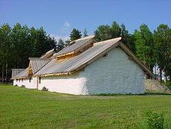
Veien Cultural Heritage Park (Veien Kulturminnepark) is in located in Hønefoss. The park contains over 100 grave mounds from the Early Iron Age, as well as a reconstructed longhouse and a museum. It is affiliated with the Buskerud Museum (Buskerudmuseet).[11]
Ridder Farm (Riddergården) is located on the north side of Hønefoss. This had been a family farm dating to 1730. The farm was largely developed by Fredrik Ridder (1756-1798) who had inherited it from his father. This was also the home of the manager of the local sawmill for generations. Ringerike Municipality has managed the property since 1964 in associated with Ringerike Museum.[12]
Notable Residents
- Karsten Alnæs - author, historian, and journalist
- Frode Andresen - Olympic gold medalist, biathlete and a cross-country skier
- Gunn Margit Andreassen- Olympic gold medalist, biathlete and a cross-country skier
- Emilie Marie Nereng - musician and model
- Anders Jacobsen - ski jumper, the youngest Norwegian to have won the Four Hills Tournament
See also
Gallery
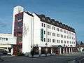 Hotell Ringerike
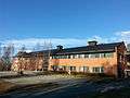 University College in Buskerud and Vestfold
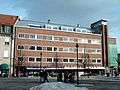 Hønefoss Brewery
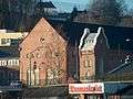 Hønefoss Power Station
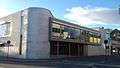 Ringerike District Court
 Hønefoss School
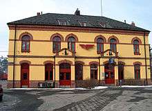 Hønefoss Train Station
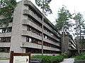 Kartverket
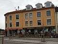 Hønefoss Cooperative
.jpg) Samfunnshuset
Samfunnshuset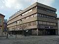 SpareBank 1
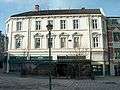 Skøiengården
 Storgaten 2
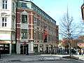 Thistedgaarden
References
- 1 2 "Urban settlements. Population and area, by municipality. 1 January 2008". Statistics Norway. 2008. Archived from the original on December 31, 2008. Retrieved 2009-01-21.
- ↑ Geir Thorsnæs. "Hønefoss". Store norske leksikon. Retrieved October 1, 2017.
- ↑ Oluf Rygh (1897) «Norske Gaardnavne». 86. Hønen
- ↑ Geir Thorsnæs. "Hønefossen". Store norske leksikon. Retrieved October 1, 2017.
- ↑ Lars Mæhlum. "Randselva". Store norske leksikon. Retrieved October 1, 2017.
- ↑ Olav Garvik. "Amedia". Store norske leksikon. Retrieved October 1, 2017.
- ↑ "-klubben historie". Hønefoss BK. Retrieved October 1, 2017.
- ↑ "Ringerike Panthers". Ringerike Ishockeyklubb. Retrieved October 1, 2017.
- ↑ "Ringerikes Museum". Stiftelsen Buskerudmuseet. Retrieved October 1, 2017.
- ↑ "Buskerud Fylkesfotoarkiv". Stiftelsen Buskerudmuseet. Retrieved October 1, 2017.
- ↑ "Veien Cultural Heritage Park". Stiftelsen Buskerudmuseet. Retrieved October 1, 2017.
- ↑ "Riddergården". kulturminnesok. Retrieved October 1, 2017.
External links
| Wikimedia Commons has media related to Hønefossen. |
| Wikivoyage has a travel guide for H%C3%B8nefoss. |
As of 1 January 2017, according to Statistics Norway | ||||||||
|  | |||||||