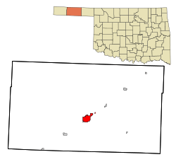
Guymon, Oklahoma
| Guymon, Oklahoma | |
|---|---|
| City | |
 Location within Texas County and Oklahoma | |
| Coordinates: 36°40′58″N 101°28′54″W / 36.68278°N 101.48167°WCoordinates: 36°40′58″N 101°28′54″W / 36.68278°N 101.48167°W[1] | |
| Country | United States |
| State | Oklahoma |
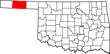
| County | Texas |
| Incorporated | 1901 |
| Government | |
| • Type | Council–Manager |
| • Mayor | Kim Peterson |
| • City Manager (Interim) | Larry Mitchell |
| Area | |
| • Total | 7.3 sq mi (19.0 km2) |
| • Land | 7.3 sq mi (18.9 km2) |
| • Water | 0.0 sq mi (0.0 km2) |
| Elevation[1] | 3,123 ft (952 m) |
| Population (2010)[2][3] | |
| • Total | 11,442 |
| • Estimate (2016) | 11,703 |
| • Density | 1,600/sq mi (600/km2) |
| Time zone | UTC-6 (CST) |
| • Summer (DST) | UTC-5 (CDT) |
| ZIP code | 73942 |
| Area code | 580 |
| FIPS code | 40-31750[1][4] |
| GNIS ID | 1093452[1] |
| Website | GuymonOK.org |
Guymon is a city in and the county seat of Texas County, Oklahoma.[1][5] As of the 2010 census, the city population was 11,442,[2] an increase of 6.5 percent from 10,472 in 2000.[6] Cattle feedlots, corporate pork farms, and natural gas dominate its economy, with wind energy production and transmission recently diversifying landowners' farms.
Guymon promotes itself with the slogan, "Queen City of the Panhandle." Some cynics apparently have coined another slogan, "Home of the Most Lied-About Weather in the U.S."[7]
History
In the 1890s, Edward T. “E.T.” Guymon, president of the Inter-State Land and Town Company, purchased a section of land west of the Beaver River, also known as the North Canadian River. The site grew very rapidly after the Chicago, Rock Island and Pacific Railway (Rock Island) built a line from Liberal, Kansas to Texhoma, Texas in 1901. A community, first named Sanford by the U.S. Post Office Department, was situated along the line. It was renamed Guymon a month later by postal officials to avoid confusion with the town of Stratford, Texas, which was further down the line. Guymon incorporated in 1901. The town plat was filed in Beaver County, Oklahoma Territory, in 1904.[6]
Guymon's growth was helped when most of the businesses moved there from the nearby town of Hardesty. One of these was the newspaper, Hardesty Herald, which owner Richard B. Quinn quickly renamed as the Guymon Herald. When Oklahoma became a state in 1907, Guymon claimed 839 residents, and was named county seat of the newly created Texas County. By the 1910 U.S. census, the town had 1,342 residents. It also had three banks, three hotels, four doctors, a flour mill, a grain company and several retail establishments. A second newspaper, the Guymon Democrat, was in business. Agriculture became the basis of Guymon's economy. The 1920 census recorded 1,507 residents, which grew to 2,181 in 1930. By 1932, the town had two cream stations and five grain elevators.[6]
The Great Depression and the Dust Bowl of the 1930s had a negative effect on Guymon. Some old-time residents remember "Black Sunday", April 14, 1935, as the day of the worst dust storm in the area's history. However, discovery of the nearby Hugoton-Panhandle gas field created many new jobs, and brought Guymon's population to 2,290 in 1940.[6]
The Guymon Pioneer Days Rodeo has offered tributes to the community’s pioneer spirit every May since 1933. In 2014 the rodeo was inducted into the ProRodeo Hall of Fame of the Professional Rodeo Cowboys Association (PRCA). In 2006, the rodeo had over 900 contestants with over $385,000 in prize money.[8]
The Anchor D Ranch, a large cattle ranch in the No Man's Land section of the Oklahoma-Texas Panhandle, is located nearby.
Geography
Located on the High Plains of the central Oklahoma Panhandle Guymon sits 122 miles (196 km) north of Amarillo, Texas and 120 miles (193 km) west-northwest of Woodward, Oklahoma. Optima National Wildlife Refuge, Optima Lake and the state-run Optima Wildlife Management Area lie roughly 16 miles (26 km) to the east along the North Canadian River.
Guymon is located at 36°40′58″N 101°28′54″W / 36.68278°N 101.48167°W (36.6828041,-101.4815493)[1][9] and sits at an elevation of 3,126 feet (953 m). According to the United States Census Bureau, the city has a total area of 7.3 square miles (18.9 km2), of which 7.3 square miles (18.9 km2) is land and 0.04 square miles (0.1 km2) (0.27%) is water.
Climate
| Climate data for Guymon, Oklahoma | |||||||||||||
|---|---|---|---|---|---|---|---|---|---|---|---|---|---|
| Month | Jan | Feb | Mar | Apr | May | Jun | Jul | Aug | Sep | Oct | Nov | Dec | Year |
| Record high °F (°C) | 83 (28) |
84 (29) |
93 (34) |
96 (36) |
102 (39) |
108 (42) |
107 (42) |
108 (42) |
106 (41) |
98 (37) |
86 (30) |
86 (30) |
108 (42) |
| Average high °F (°C) | 48 (9) |
52 (11) |
58 (14) |
69 (21) |
78 (26) |
89 (32) |
93 (34) |
92 (33) |
85 (29) |
74 (23) |
59 (15) |
51 (11) |
71 (22) |
| Average low °F (°C) | 21 (−6) |
25 (−4) |
29 (−2) |
41 (5) |
50 (10) |
61 (16) |
65 (18) |
65 (18) |
56 (13) |
44 (7) |
30 (−1) |
24 (−4) |
43 (6) |
| Record low °F (°C) | −19 (−28) |
−11 (−24) |
−7 (−22) |
17 (−8) |
28 (−2) |
41 (5) |
48 (9) |
46 (8) |
31 (−1) |
24 (−4) |
4 (−16) |
0 (−18) |
−19 (−28) |
| Average precipitation inches (mm) | 0.5 (13) |
0.9 (23) |
0.8 (20) |
1.7 (43) |
3.1 (79) |
2.5 (64) |
3.5 (89) |
2.8 (71) |
1.9 (48) |
1.8 (46) |
0.8 (20) |
0.6 (15) |
20.9 (531) |
| Average snowfall inches (cm) | 3.2 (8.1) |
3.9 (9.9) |
3.3 (8.4) |
1 (3) |
0.1 (0.3) |
0 (0) |
0 (0) |
0 (0) |
0 (0) |
0.2 (0.5) |
1.3 (3.3) |
3.5 (8.9) |
16.5 (41.9) |
| Average rainy days | 1.6 | 2.6 | 2.2 | 4.3 | 6.2 | 4.9 | 6.2 | 5.4 | 3.6 | 3.4 | 2 | 2 | 44.4 |
| Average relative humidity (%) | 75 | 71 | 62 | 67 | 59 | 58 | 58 | 54 | 55 | 61 | 58 | 73 | 63 |
| Source #1: weather.com | |||||||||||||
| Source #2: Weatherbase.com[10] | |||||||||||||
Demographics
| Historical population | |||
|---|---|---|---|
| Census | Pop. | %± | |
| 1910 | 1,342 | — | |
| 1920 | 1,507 | 12.3% | |
| 1930 | 2,181 | 44.7% | |
| 1940 | 2,290 | 5.0% | |
| 1950 | 4,718 | 106.0% | |
| 1960 | 5,768 | 22.3% | |
| 1970 | 7,674 | 33.0% | |
| 1980 | 8,492 | 10.7% | |
| 1990 | 7,803 | −8.1% | |
| 2000 | 10,472 | 34.2% | |
| 2010 | 11,442 | 9.3% | |
| Est. 2016 | 11,703 | [11] | 2.3% |
| U.S. Decennial Census[12] | |||
As of the 2010 census, there were 11,442 people, 3,651 households, and 2,632 families residing in the city. The population density was 1,600 people per square mile (600/km²). There were 3,941 housing units at an average density of 539.4 per square mile (208.2/km²). The racial makeup of the city as of 2016 was 59.0% Hispanic, 35.7% White, 3.0% Black, 2.3% Asian, 2.0% of two or more races, and 0.2% Native American.[13]
There were 3,651 households out of which 39.8% had children under the age of 18 living with them, 59.0% were married couples living together, 8.7% had a female householder with no husband present, and 27.9% were non-families. 21.5% of all households were made up of individuals and 8.5% had someone living alone who was 65 years of age or older. The average household size was 2.82 and the average family size was 3.26.
In the city, the population was spread out with 29.1% under the age of 18, 12.0% from 18 to 24, 30.6% from 25 to 44, 18.3% from 45 to 64, and 10.0% who were 65 years of age or older. The median age was 30 years. For every 100 females, there were 106.1 males. For every 100 females age 18 and over, there were 107.9 males.
The median income for a household in the city was $37,333, and the median income for a family was $44,841. Males had a median income of $26,162 versus $20,450 for females. The per capita income for the city was $15,682. About 10.1% of families and 14.3% of the population were below the poverty line, including 18.7% of those under age 18 and 5.2% of those age 65 or over.
In the 2010 census, Guymon had the fourth largest Hispanic population among cities in the state, trailing only Oklahoma City, Tulsa and Lawton.[6]
Economy
Guymon is a hub for the local economy, which includes wheat farming, livestock and dairy farming, manufacturing, and oil and natural gas production. A United States soil conservation station is located nearby. Local manufacturers produce agricultural tillage tools, pressure tanks, and formula feeds. The town of Goodwell, Oklahoma, home of Oklahoma Panhandle State University, lies 11 miles (18 km) to the southwest of Guymon.
Opening of the Hugoton-Panhandle Gas Field led to the establishment of two carbon black plants, the Dandee Manufacturing Company (makers of farming equipment), an ice plant, the OK Welding Manufacturing Company, a feed mill, the Phillips Petroleum cracking plant, and the Southwestern Public Service Company generating plant. The Guymon Municipal Hospital (later renamed Memorial Hospital of Texas County) opened in 1949.[6]
The city's largest employer, Seaboard pork processing plant, operates at double shift capacity and processes about 18,000 hogs each day, and its 2,300 employees make up about 20% of the entire city's population. Hitch Ranch, which began opening cattle feed lots during the 1960s, is the city's second largest employer. A Swift and Company packing plant is located near Hitch Ranch. The City of Guymon, the Panhandle Telephone Cooperative, and the hospital round out the list of top employers.[6]
A movement to harness wind power for electricity generation began a large-scale boom in the Guymon area in 2011. The DeWind Company had two 40 megawatt projects online (near Goodwell) in 2012, while a 200 megawatt project has been announced.[14]
Government
Guymon has a council-manager form of government,[6] Larry Mitchell is the Interim City Manager (October, 2016).[15]
Education
Guymon residents are served by the Guymon School District. The school system was begun in 1902-3. The first high school building was built in 1917. Guymon schools were closed for one year during the Great Depression because there were insufficient funds to keep them operating. The school district opened a new high school in 1954. This was replaced with a new facility in 1974.[6]
The city has eight elementary schools, one junior high school and one high school, whose team mascot is the Tiger.[16]
- Elementary Schools
- Middle School
- High School
More than eighty percent of high school students qualify for a reduced-price school lunch, a common proxy for poverty.[17]
About 30% of residents lacking a high school diploma, the city has the lowest educational level in the state.[18] Guymon High School lags behind the state in several measures.
| Subject | State Average | Guymon HS [19] |
|---|---|---|
| HS Graduation Rate | 84% | 67% |
| English Language Arts | 79% | 65% |
| Math exam | 74% | 47% |
Media
Guymon has one newspaper and four radio stations, although one is a translator.
- Guymon Herald printed since 1891 is the only daily newspaper for the entire Oklahoma Panhandle[20]
- KKBS 92.7 FM - Rock
- KBIJ 99.5 FM - Regional Mexican
- KGYN 1210 AM - Classic Country
- K215CV 90.9 FM - Christian Contemporary (Air1)
Recreation
- Sunset Hills golf course – an 18-hole par-71 municipal course open to members and guests in Guymon.
- Sunset Lake and Thompson Park – a 32-acre stocked municipal lake is open to fishing year-round, with paddle boats, an operating miniature train, ducks to be fed, playground equipment for children, picnic tables, and covered pavilions.
- No Mans Land Rifle & Pistol Club – A 50-station handgun and rimfire rifle range open to members of the club, located near Sunset Lake and Thompson Park, and open for use during daylight hours.
- Nearby Optima National Wildlife Refuge offers bird and wildlife viewing opportunities, and the Optima Wildlife Management Area, run by the Oklahoma Department of Wildlife Conservation, offers hunting opportunities.
Infrastructure
Transportation
Guymon Municipal Airport is a city-owned, public-use airport located two nautical miles (3.7 km) west of the central business district of Guymon.
Notable people
- Claudia Bryar (1918-2011) - film and television actress, born in Guymon.
- Michael D. Brown – former FEMA Director under President George W. Bush, was born in Guymon in 1955.
- F. Hiner Dale (1881–1968) – Oklahoma State Court Judge and founder of Guymon law firm of Wright, Dale, and Jett.
- Gordon Grice (b. 1965) – award-winning nature writer, born in Guymon.
- Ross Rizley (1892-1969) - former U.S. Representative, buried in Guymon.
- Sammi Smith (1943-2005) - Born Jewel Faye Smith, country star whose greatest hit was the Kris Kristofferson-penned megahit, "Help Me Make It Through the Night" - buried in Guymon.
See also
References
- 1 2 3 4 5 6 Geographic Names Information System (GNIS) details for Guymon, Oklahoma; United States Geological Survey (USGS); December 18, 1979.
- 1 2 "2010 City Population and Housing Occupancy Status". U.S. Census Bureau. Retrieved April 6, 2011.
- ↑ 2012 Census estimates for Guymon; census.gov Archived 2013-12-25 at the Wayback Machine.
- ↑ "American FactFinder". United States Census Bureau. Retrieved 2008-01-31.
- ↑ "Find a County". National Association of Counties. Retrieved 2011-06-07.
- 1 2 3 4 5 6 7 8 9 Larry O'Dell, "Guymon," Encyclopedia of Oklahoma History and Culture. Accessed August 4, 2015
- ↑ Etter, Jim. "Catchy Slogans Strive to Put Towns on Map." The Oklahoman. October 20, 1985. Accessed November 3, 2016.
- ↑ "Guymon Pioneer Days Rodeo". Retrieved 2008-04-23.
- ↑ "US Gazetteer files: 2010, 2000, and 1990". United States Census Bureau. 2011-02-12. Retrieved 2011-04-23.
- ↑ "Historical Weather for Guymon, Oklahoma, United States".
- ↑ "Annual Estimates of the Resident Population for Incorporated Places: April 1, 2010 to July 1, 2015". Retrieved July 2, 2016.
- ↑ "Incorporated Places and Minor Civil Divisions Datasets: Subcounty Population Estimates: April 1, 2010 to July 1, 2012". U.S. Census Bureau. Archived from the original on 17 June 2013. Retrieved 25 November 2013.
- ↑ http://www.city-data.com/city/Guymon-Oklahoma.html
- ↑ "Oklahoma Wind Energy Projects." Kansas Energy Information Network. Accessed August 4, 2015.
- ↑ City of Guymon web page. Archived 2016-10-05 at the Wayback Machine. Accessed October 3, 2016
- ↑ "Guymon Public Schools District Home". Guymon Public Schools District. Archived from the original on 2008-05-09. Retrieved 2008-04-23.
- ↑ "Guymon High School". National Center for Educational Statisitics. US Department of Education. Retrieved 7 March 2018.
- ↑ "Educational Attainment by Place in Oklahoma". Statisitcal Atlas. Retrieved 7 March 2018.
- ↑ "Guymon High School in Guymon, Oklahoma". Startclass.com. Retrieved 7 March 2018.
- ↑ "About The Guymon Daily Herald". Guymon Daily Herald. 2006-09-08. Archived from the original on 2008-04-30. Retrieved 2008-04-23.
External links
| Wikimedia Commons has media related to Guymon, Oklahoma. |
| Wikivoyage has a travel guide for Guymon. |