Adams, Oklahoma
| Adams | |
|---|---|
| Unincorporated community | |
 Adams Location within the state of Oklahoma  Adams Adams (the US) | |
| Coordinates: 36°45′23″N 101°4′38″W / 36.75639°N 101.07722°WCoordinates: 36°45′23″N 101°4′38″W / 36.75639°N 101.07722°W[1] | |
| Country | United States |
| State | Oklahoma |
| County | Texas |
| Elevation[1] | 2,841 ft (866 m) |
| Population (2000) | |
| • Total | 182 |
| Time zone | UTC-6 (Central (CST)) |
| • Summer (DST) | UTC-5 (CDT) |
| ZIP codes | 73901 |
| Area code(s) | 580 |
Adams is a rural unincorporated community in eastern Texas County, Oklahoma, United States.[1] It is about 20 miles (32 km) east-northeast of the county seat, Guymon, Oklahoma.[2] The community is six miles NNE of Optima Lake.[3] The post office opened June 14, 1930. The community was named for Jesse L. Adams, engineer for the Rock Island Railroad.[4]
It is the site of the Adams Woodframe Grain Elevator, which is listed on the National Register of Historic Places (NRHP). The community and its elevator were both established in 1926. The elevator has been unusable since the 1980s, and is now condemned because of its danger of collapse.[2]
References
- 1 2 3 U.S. Geological Survey Geographic Names Information System: Adams, Oklahoma
- 1 2 Culver, Galen. "Oklahoma’s Leaning Tower: The old Adams grain elevator is in a gravity defying, slow-motion fall." News4. August 18, 2017. Accessed December 10, 2017.
- ↑ Oklahoma Atlas & Gazeteer, DeLorme, 1st ed., 1998, p. 16 ISBN 0899332838
- ↑ Shirk, George H., Oklahoma Place Names, Norman: University of Oklahoma Press, 1987, p. 4 ISBN 0-8061-2028-2
Municipalities and communities of Texas County, Oklahoma, United States | ||
|---|---|---|
| Cities | 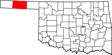 | |
| Towns | ||
| Unincorporated communities | ||
This article is issued from
Wikipedia.
The text is licensed under Creative Commons - Attribution - Sharealike.
Additional terms may apply for the media files.