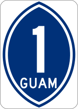
Guam Highway 1
| ||||
|---|---|---|---|---|
| Marine Corps Drive | ||||
 GH-1 highlighted in red | ||||
| Route information | ||||
| Maintained by Guam DPW | ||||
| Length | 21.04 mi[1] (33.86 km) | |||
| Existed | c. 1941[2] – present | |||
| Major junctions | ||||
| West end |
| |||
|
| ||||
| East end |
| |||
| Highway system | ||||
| ||||
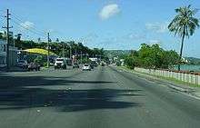
Guam Highway 1 (GH-1), also known as Marine Corps Drive, is one of the primary automobile routes in the United States territory of Guam. It runs in a southwest-to-northeast direction, from the main gate of Naval Base Guam in the western community of Santa Rita in a general northeasterly direction to the main gate of Andersen Air Force Base in the community of Yigo. It passes through Guam's capital, Hagåtña, as well as intersecting various other territorial highways. Along its route, the highway runs through tropical forest areas, urbanized commercial areas, and residential neighborhoods. The US Military built the road starting in 1941. Construction ceased with the Japanese invasion in December 1941 and resumed in 1944. The highway was formally dedicated to the US Marines by the territorial governor in 2004.
Route description
GH-1 begins near the entrance gate to Naval Base Guam, at a junction with GH-2A. Known as Marine Corps Drive, the route then travels to the northeast through tropical forests along Apra Harbor to the town of Piti. After passing through Piti, the drive runs along Tepungon Beach before turning inland near Asan Point. The road passes the US Naval Hospital and Asan Point; then it runs parallel to the coast along Asan Memorial Beach through the community of Asan. Soon thereafter, Marine Corps Drive cuts a path due east towards the Island's capital, Hagåtña where it passes through the northern edge of the city. In this area, GH-1 runs through commercial areas parallel to the West Agaña Beach Front area. The drive passes the Paseo de Susana before following Trinchera Beach northeasterly through town.[3][4]
After passing through the capital and the community of Mongmong, the road turns towards the northeast as it skirts to the west of Antonio B. Won Pat International Airport on its way through the village of Tamuning. After the airport, the highway runs inland from the shoreline through the neighborhood of Tumon. It runs northeasterly around the Micronesia Mall before turning southeasterly through residential areas as it cuts across the southern edges of Dededo. It runs to the south of the Guam International Country Club and to the north of the Andersen Air Force Base's southern unit. Through this area, the north side of the highway is residential areas, and the south side is tropical forests. Marine Corps Drive passes the War Dead Cemetery and turns northeasterly residential areas on both sides of the roadway through Yigo before reaching its terminus at Salisbury Junction, the main entrance to the Air Force Base, where the road continues to the northwest as GH-9.[3][4]
Like most major highways on Guam, a 35 mph (56 km/h) speed limit is posted throughout most of its length. In the past, GH-1 was one of the few roads to post a 45 mph (72 km/h) limit on lengths of less-developed roadway. However, as more of the area became developed, certain sections of the roads were posted with lower limits. Travelers heading north away from the developed areas are allowed a 45 mph (72 km/h) speed limit. However, the southbound lanes on the same sections remain posted at 35 mph (56 km/h) due to development on the western side of the road.[5]
History
The United States Military began to develop and construct roads on the island in 1941. Some roads had existed prior to this, but improvements were beginning to take shape. Only one road, which encircled most of the island, had been graded. It was the primary route linking Agana (the name of the capital at the time) to Piti and Asan. This was the foundation for Marine Corps Drive. After the Japanese invasion, little infrastructure improvements were made by the occupiers. Road construction resumed by the US Military after the island was invaded in 1944. In 60 days, a 12-mile (19 km), four-lane super-highway with nine bridges was built after the invasion. The remainder of the roadway was built and numbered under the local administration after Guam was given civil government in 1950.[2]
Named Marine Corps Drive throughout its length, it was known as simply Marine Drive until the road was rededicated by Governor Felix Perez Camacho in 2004.[6] In 2012, the DPW has started to install LED streetlights along Marine Corps Drive. [7] At the same time, construction has started to replace the Agana Bridge along GH-1.[8]
Major intersections
| Location | mi[1] | km | Destinations | Notes | |
|---|---|---|---|---|---|
| Santa Rita | 0.00 | 0.00 | Entrance to Naval Base Guam | Western terminus | |
| 0.05 | 0.080 | Northern terminus of GH-2A | |||
| Piti | 2.72 | 4.38 | Eastern terminus of GH-18 | ||
| 2.82 | 4.54 | Western terminus of GH-6 | |||
| 3.10 | 4.99 | Eastern terminus of GH-11 | |||
| Asan | 6.00 | 9.66 | Eastern terminus of GH-6 | ||
| Hagåtña | 7.66 | 12.33 | Eastern terminus of GH-4 | ||
| 7.84 | 12.62 | Western terminus of GH-8 | |||
| Tamuning | 10.34 | 16.64 | Southern terminus of GH-14B | ||
| 10.70 | 17.22 | Western terminus of GH-10A | |||
| Tumon | 11.30 | 18.19 | Southern terminus of GH-14A | ||
| 13.19 | 21.23 | Western terminus of GH-16 | |||
| 13.29 | 21.39 | Southern terminus of GH-34 | |||
| 13.79 | 22.19 | Southern terminus of GH-3 | |||
| Dededo | 13.99 | 22.51 | Eastern terminus of GH-27A | ||
| 14.70 | 23.66 | Eastern terminus of GH-27 | |||
| 15.11 | 24.32 | Northern terminus of GH-26 | |||
| 15.30 | 24.62 | Southern terminus of GH-28 | |||
| Yigo | 18.92 | 30.45 | Western terminus of GH-29 | ||
| 21.04 | 33.86 | Eastern terminus; entrance to Andersen Air Force Base | |||
| 1.000 mi = 1.609 km; 1.000 km = 0.621 mi | |||||
See also

References
- 1 2 U.S. Census Bureau (January 1, 2006). "2006 Second Edition TIGER/Line File". U.S. Census Bureau. Retrieved February 19, 2008.
- 1 2 National Park Service (May 3, 2004). "Part 2a: History". Cultural Landscapes Inventory: Asan and Agat Invasion Beaches, War in the Pacific National Historical Park. National Park Service. Retrieved February 19, 2008.
- 1 2 Unpingco, Bert; Nielsen, Frank M. (January 2007). Franko's Guide Map of Guam (Map). Scale not given. Corona, CA: Franko's Maps. §§ D2–C4, K7–J8. ISBN 1-60190-090-2.
- 1 2 Google (April 19, 2012). "Overview Map of Guam Highway 1" (Map). Google Maps. Google. Retrieved April 19, 2012.
- ↑ Davis, John (January 3, 2008). "One Road, Two Speed Limits? Better Believe It". Hagåtña, GU: KUAM-TV. Archived from the original on April 19, 2012. Retrieved February 23, 2008.
- ↑ Eusebio, Marissa (April 13, 2004). "Governor Signs Order to Rename Marine Drive to 'Marine Corps Drive'". Hagåtña, GU: KUAM-TV. Retrieved October 31, 2006.
- ↑ Temkar, Arvin (April 19, 2012). "Conference Kicks off on Sustainability". Pacific Daily News. Retrieved April 19, 2012.
- ↑ Kelman, Brett (April 5, 2012). "Agana Bridge Groundbreaking April 16". Pacific Daily News. Retrieved April 19, 2012.
External links
Route map: