Grove City, Ohio
| Central Crossing, Ohio | |
|---|---|
| City | |
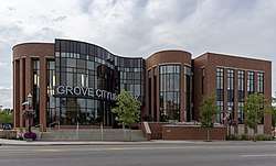 Grove City Library | |
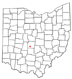 Location of Grove City, Ohio | |
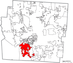 Location of Grove City in Franklin County | |
| Coordinates: 39°52′41″N 83°4′41″W / 39.87806°N 83.07806°WCoordinates: 39°52′41″N 83°4′41″W / 39.87806°N 83.07806°W | |
| Country | United States |
| State | Ohio |
| County | Franklin |
| Area[1] | |
| • Total | 16.36 sq mi (42.37 km2) |
| • Land | 16.20 sq mi (41.96 km2) |
| • Water | 0.16 sq mi (0.41 km2) |
| Elevation[2] | 850 ft (259 m) |
| Population (2010)[3] | |
| • Total | 35,575 |
| • Estimate (2012[4]) | 36,832 |
| • Density | 2,196.0/sq mi (847.9/km2) |
| Time zone | UTC-5 (Eastern Time) |
| • Summer (DST) | UTC-4 |
| ZIP code | 43123 |
| Area code(s) | 614 |
| FIPS code | 39-32592[5] |
| GNIS feature ID | 1048806[2] |
| Website | City website |
Grove City is a city in Franklin County, Ohio, United States which was founded in 1852. It is a suburb of Columbus. The population was 35,575 at the 2010 census.
History
Grove City was laid out in 1852.[6]
Geography
Grove City is located at 39°52′41″N 83°04′41″W / 39.878030°N 83.078157°W.[7]
According to the United States Census Bureau, the city has a total area of 16.36 square miles (42.37 km2), of which 16.20 square miles (41.96 km2) is land and 0.16 square miles (0.41 km2) is water.[1]
Demographics
| Historical population | |||
|---|---|---|---|
| Census | Pop. | %± | |
| 1870 | 143 | — | |
| 1880 | 150 | 4.9% | |
| 1890 | 272 | 81.3% | |
| 1900 | 656 | 141.2% | |
| 1910 | 897 | 36.7% | |
| 1920 | 905 | 0.9% | |
| 1930 | 1,546 | 70.8% | |
| 1940 | 1,787 | 15.6% | |
| 1950 | 2,339 | 30.9% | |
| 1960 | 8,107 | 246.6% | |
| 1970 | 13,911 | 71.6% | |
| 1980 | 16,688 | 20.0% | |
| 1990 | 19,661 | 17.8% | |
| 2000 | 27,075 | 37.7% | |
| 2010 | 35,575 | 31.4% | |
| Est. 2017 | 41,022 | [8] | 15.3% |
| US Census[9][10] | |||
2010 census
As of the census[3] of 2010, there were 35,575 people, 13,946 households, and 9,585 families residing in the city. The population density was 2,196.0 inhabitants per square mile (847.9/km2). There were 14,720 housing units at an average density of 908.6 per square mile (350.8/km2). The racial makeup of the city was 92.6% White, 2.8% African American, 0.2% Native American, 1.3% Asian, 1.0% from other races, and 2.1% from two or more races. Hispanic or Latino of any race were 2.6% of the population.
There were 13,946 households of which 35.3% had children under the age of 18 living with them, 52.2% were married couples living together, 11.8% had a female householder with no husband present, 4.7% had a male householder with no wife present, and 31.3% were non-families. 25.6% of all households were made up of individuals and 9.7% had someone living alone who was 65 years of age or older. The average household size was 2.53 and the average family size was 3.04.
The median age in the city was 37.8 years. 25.4% of residents were under the age of 18; 8.4% were between the ages of 18 and 24; 27.4% were from 25 to 44; 26.6% were from 45 to 64; and 12.2% were 65 years of age or older. The gender makeup of the city was 48.3% male and 51.7% female.
2000 census
As of the census[5] of 2000, there were 27,075 people, 10,265 households, and 7,544 families residing in the city. The population density was 1,941.2 people per square mile (749.4/km2). There were 10,712 housing units at an average density of 768.0 per square mile (296.5/km2). The racial makeup of the city was 96.17% White, 1.54% African American, 0.22% Native American, 0.60% Asian, 0.01% Pacific Islander, 0.34% from other races, and 1.11% from two or more races. Hispanic or Latino of any race were 1.17% of the population.
There were 10,265 households out of which 37.8% had children under the age of 18 living with them, 59.5% were married couples living together, 10.3% had a female householder with no husband present, and 26.5% were non-families. 22.4% of all households were made up of individuals and 8.3% had someone living alone who was 65 years of age or older. The average household size was 2.61 and the average family size was 3.07.
In the city, the population was spread out with 28.3% under the age of 18, 7.4% from 18 to 24, 31.6% from 25 to 44, 21.7% from 45 to 64, and 11.1% who were 65 years of age or older. The median age was 35 years. For every 100 females, there were 94.4 males. For every 100 females age 18 and over, there were 89.8 males.
The median income for a household in the city was $52,064, and the median income for a family was $62,059. Males had a median income of $40,599 versus $30,399 for females. The per capita income for the city was $22,305. About 3.3% of families and 4.6% of the population were below the poverty line, including 5.3% of those under age 18 and 4.8% of those age 65 or over.
Government
Grove City is operated based on a city charter that was originally written in 1958 and later amended in 1982. The charter gives the city's power to a Mayor, City Council and Administrator. Of the three, the Administrator is the only appointed position, while the other two are elected. The current mayor of Grove City is Richard L. (Ike) Stage.
It is located in the South-Western City School District.
Grove City is split between Ohio's 3rd and Ohio's 15th congressional district. The city is also split between Ohio's 3rd senatorial district and Ohio's 16th senatorial district and its Ohio State House Districts are OH-17, OH-23, and OH-24. [11]
National Register of Historic Places
- Gantz Homestead at 2233 Gantz Road, added in 1979
- A.G. Grant Homestead at 4124 Haughn Road, added in 1998.
- Century Village orders road
Notable people
- Gary Burley, former professional football player who played for the Bengals in Super Bowl XVI
- Derek Combs, Mr. Football Ohio 1996, and professional football player
- Richard Cordray, former Director of the Consumer Financial Protection Bureau
- Craig McDonald, author, journalist
- Mike Mayers, Major League Baseball pitcher who debuted for the St. Louis Cardinals
- Pat O’Conner, Minor League Baseball executive
- Ben Swanson, professional soccer player for Columbus Crew
- Tyler Joseph, band member of TwentyOnePilots lead singer
- Josh Dun, band member of TwentyOnePilots drummer
Sister city

Gallery
 Gold Star Memorial Monument
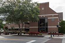
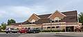 Grove City Municipal Safety Complex
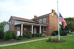
 A.G. Grant Homestead
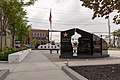
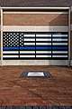 Grove City Police Memorial
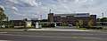 Grove City Medical Center Under Construction (2018)
See also
References
- 1 2 "US Gazetteer files 2010". United States Census Bureau. Archived from the original on 2012-01-24. Retrieved 2013-01-06.
- 1 2 "US Board on Geographic Names". United States Geological Survey. 2007-10-25. Retrieved 2008-01-31.
- 1 2 "American FactFinder". United States Census Bureau. Retrieved 2013-01-06.
- ↑ "Population Estimates". United States Census Bureau. Archived from the original on 2013-06-17. Retrieved 2013-06-17.
- 1 2 "American FactFinder". United States Census Bureau. Archived from the original on 2013-09-11. Retrieved 2008-01-31.
- ↑ Overman, William Daniel (1958). Ohio Town Names. Akron, OH: Atlantic Press. p. 55.
- ↑ "US Gazetteer files: 2010, 2000, and 1990". United States Census Bureau. 2011-02-12. Retrieved 2011-04-23.
- ↑ "Population and Housing Unit Estimates". Retrieved May 26, 2018.
- ↑ Data in historical population table from US Census, 1890 ; "American Factfinder". US Census Bureau. .
- ↑ "Incorporated Places and Minor Civil Divisions Datasets: Subcounty Population Estimates: April 1, 2010 to July 1, 2012". U.S. Census Bureau. Archived from the original on 17 June 2013. Retrieved 25 November 2013.
- ↑ "Overview of Grove City, Ohio (City)". statisticalatlas.com. Retrieved 25 August 2018.
External links
- City website
- Grove City Town Center Inc.
- Grove City Visitors Bureau
- Grove City Chamber of Commerce
- Grove City, Ohio at Curlie (based on DMOZ)
Municipalities and communities of Franklin County, Ohio, United States | ||
|---|---|---|
| Cities | 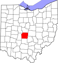 | |
| Villages | ||
| Townships | ||
| CDPs | ||
| Unincorporated communities | ||
| Footnotes | ‡This populated place also has portions in an adjacent county or counties | |