Griswold, Manitoba
| Griswold | |
|---|---|
 Griswold Location of Griswold in Manitoba | |
| Coordinates: 49°46′30″N 100°28′15″W / 49.77500°N 100.47083°WCoordinates: 49°46′30″N 100°28′15″W / 49.77500°N 100.47083°W | |
| Country |
|
| Province |
|
| Region | Westman |
| Census Division | No. 6 |
| Government | |
| • Governing Body | Rural Municipality of Sifton Council |
| • MP | Larry Maguire |
| • MLA | Vacant |
| Time zone | UTC−6 (CST) |
| • Summer (DST) | UTC−5 (CDT) |
| Postal Code | R0M 0S0 |
| Area code(s) | 204, 431 |
| NTS Map | 062F16 |
| GNBC Code | GAJXS |
Griswold is an unincorporated place located within the Rural Municipality of Sifton in south-western Manitoba, Canada. It is located approximately 38 kilometers (24 miles) southwest of Brandon, Manitoba.[1]
References
- ↑ "Geographical Names of Canada - Querying Distances". nrcan.gc.ca. 2011-10-24. Retrieved 2013-02-23.
| Towns | 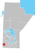 | ||
|---|---|---|---|
| Villages |
| ||
| Rural municipalities |
| ||
| First Nations | |||
| Unincorporated communities | |||
This article is issued from
Wikipedia.
The text is licensed under Creative Commons - Attribution - Sharealike.
Additional terms may apply for the media files.