Kenton, Manitoba
Kenton is an unincorporated community recognized as a local urban district[1] in Manitoba, Canada. It is located in the Rural Municipality of Woodworth, about an hour's drive west of Brandon. The first permanent settlement of the area began in 1881, following the westward expansion of the borders of the province of Manitoba. The settlement was named for its first postmaster, A.W. Kent.[2] Kenton became an unincorporated village district in 1947.[3] In 1986, the community had a population of 158.[4] Water supply for the community is from the nearby half-mile long Kenton Reservoir on Bars Creek, a tributary of the Oak River. The 600 acre foot reservoir was constructed in 1969 by the Prairie Farm Rehabilitation Administration [5] and also provides an opportunity for sport fishing. Kenton is the location of the municipal council chamber for the RM of Woodworth.
Services
A railway branch line connected Kenton in 1902. The local lighting plant was replaced with a connection to the provincial electric power grid in 1931. The Rural Municipality of Woodworth ran its own municipal telephone system from 1907 with the main exchange at Kenton, until the system was sold to the provincial telephone company in 1946.
References
- ↑ "Local Urban Districts Regulation". Government of Manitoba. April 23, 2016. Retrieved April 24, 2016.
- ↑ http://www.insurancewest.ca/pdffiles/IW_nov06_11-20.pdf retrieved 2011 Dec 1
- ↑ Dorthy Vipond, Proudly we speak: a history of the Rural Municipality of Woodworth, Woodworth Centennial Committee, 1967, http://www.ourroots.ca/e/page.aspx?id=482986
- ↑ http://mbair.brandonu.ca/figure/display/16.4 Manitoba from the air, retrieved 2011 12 01
- ↑ http://uarcd.com/PDFs/OctWPATLgeDam.pdf retrieved 2011 12 01
| Towns | 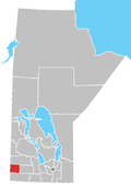 | ||
|---|---|---|---|
| Villages |
| ||
| Rural municipalities |
| ||
| First Nations | |||
| Unincorporated communities | |||
Coordinates: 49°59′15″N 100°36′51″W / 49.98750°N 100.61417°W