Gressier
| Gressier Gresye | |
|---|---|
| Commune | |
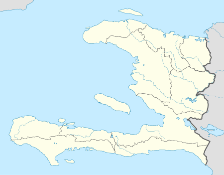 Gressier Location in Haiti | |
| Coordinates: 18°33′0″N 72°31′0″W / 18.55000°N 72.51667°WCoordinates: 18°33′0″N 72°31′0″W / 18.55000°N 72.51667°W | |
| Country |
|
| Department | Ouest |
| Arrondissement | Port-au-Prince |
| Area | |
| • Total | 89.8 km2 (34.7 sq mi) |
| Elevation | 16 m (52 ft) |
| Population (7 August 2003)[1] | |
| • Total | 25,947 |
| • Density | 288.9/km2 (748/sq mi) |
Gressier (Haitian Creole: Gresye) is a commune in the Port-au-Prince Arrondissement, in the Ouest department of Haiti. It has 25,947 inhabitants.
According to the CAGH – Committee for the Advancement of Gressier, Gressier has a population of about 75,000. It is located approximately 12.5miles west of Port-au-Prince. With a total land area of 41.11 square miles, it is bordered on the north by the Gulf of La Gonâve. On the east, Gressier is bordered by the town of Carrefour, on the south by the Momance River, and on the west by the town of Leôgane. It has three main rural sections: Morne à Bateau, Morne à Chandelle, and Petit Toucan. [2]
2010 7.0 earthquake
A UN assessment team estimated that 40 to 50 per cent of the buildings in Gressier were destroyed in the 12 January 2010 earthquake.[3] The "court of the peace" building was destroyed in the tremblor.[4]
ROKENGCOY, South Korea Engineering Company, is in Gressier since February 2010 to help with demolition and reconstruction, also with medical assistance.
References
- ↑ Institut Haïtien de Statistique et d'Informatique (IHSI)
- ↑ http://www.gressier.org/about.aspx
- ↑ ABC News, 'Haiti Disaster Like "No Other"', AFP, Lisa Millar, 17 January 2010 (accessed 17 January 2010)
- ↑ (in French) Metropole Haiti, "Le système judiciaire paralysé trois semaines après le séisme", LLM, 5 February 2010 (accessed 6 February 2010)
External links
- Reuters, "Gressier atlas of building damage assessment", 26 February 2010
