Greenwood Township, Christian County, Illinois
| Greenwood Township | |
|---|---|
| Township | |
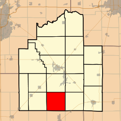 Location in Christian County | |
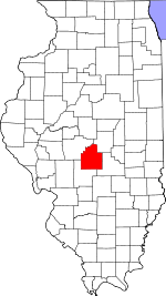 Christian County's location in Illinois | |
| Coordinates: 39°23′59″N 89°18′16″W / 39.39972°N 89.30444°WCoordinates: 39°23′59″N 89°18′16″W / 39.39972°N 89.30444°W | |
| Country |
|
| State |
|
| County | Christian |
| Established | November 7, 1865 |
| Area | |
| • Total | 36.68 sq mi (95.0 km2) |
| • Land | 36.68 sq mi (95.0 km2) |
| • Water | 0 sq mi (0 km2) 0% |
| Elevation | 630 ft (192 m) |
| Population (2010) | |
| • Estimate (2016)[1] | 199 |
| • Density | 5.7/sq mi (2.2/km2) |
| Time zone | UTC-6 (CST) |
| • Summer (DST) | UTC-5 (CDT) |
| ZIP codes | 62075, 62546, 62555, 62556, 62557 |
| FIPS code | 17-021-31641 |
Greenwood Township is one of seventeen townships in Christian County, Illinois, USA. As of the 2010 census, its population was 208 and it contained 96 housing units.[2]
Geography
According to the 2010 census, the township has a total area of 36.68 square miles (95.0 km2), all land.[2]
Unincorporated towns
Cemeteries
The township contains these four cemeteries: Antioch Methodist, Center Grove Methodist, Fairview Methodist and Kettlecamp Methodist.
Airports and landing strips
- Dahler Airport
- Dooley Field
- Kottwitz Landing Strip
Demographics
| Historical population | |||
|---|---|---|---|
| Census | Pop. | %± | |
| Est. 2016 | 199 | [1] | |
| U.S. Decennial Census[3] | |||
School districts
- Morrisonville Community Unit School District 1
- Nokomis Community Unit School District 22
- Pana Community Unit School District 8
- Taylorville Community Unit School District 3
Political districts
- State House District 98
- State Senate District 49
References
- "Greenwood Township, Christian County, Illinois". Geographic Names Information System. United States Geological Survey. Retrieved 2010-01-04.
- United States Census Bureau 2009 TIGER/Line Shapefiles
- United States National Atlas
- 1 2 "Population and Housing Unit Estimates". Retrieved June 9, 2017.
- 1 2 "Population, Housing Units, Area, and Density: 2010 - County -- County Subdivision and Place -- 2010 Census Summary File 1". United States Census. Retrieved 2013-05-28.
- ↑ "Census of Population and Housing". Census.gov. Retrieved June 4, 2016.
External links
Places adjacent to Greenwood Township, Christian County, Illinois | |
|---|---|
Municipalities and communities of Christian County, Illinois, United States | ||
|---|---|---|
| Cities | ||
| Villages | ||
| Townships | ||
| CDP | ||
| Other unincorporated communities | ||
| Footnotes | ‡This populated place also has portions in an adjacent county or counties | |
This article is issued from
Wikipedia.
The text is licensed under Creative Commons - Attribution - Sharealike.
Additional terms may apply for the media files.