Greensand Ridge Walk
| Greensand Ridge Walk | |
|---|---|
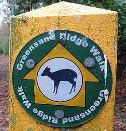 Waymarker denoting the route of the Greensand Ridge Walk | |
| Length | 64 km (40 mi) |
| Location | South Central England, United Kingdom |
| Trailheads |
Gamlingay, Cambridgeshire Leighton Buzzard, Bedfordshire |
| Use | Hiking |
| Hiking details | |
| Season | All year |
| Website | http://www.greensandridgewalk.co.uk/ |
The Greensand Ridge Walk is a long-distance walk of 40 miles (64 km) that traverses the county of Bedfordshire in England, with brief sections in the neighbouring counties of Cambridgeshire and Buckinghamshire. Its southern endpoint is at Leighton Buzzard and the route runs north-east to finish at Gamlingay.[1] As can be inferred from the name, the walk follows the Bedfordshire Greensand Ridge (not to be confused with the Greensand Way, the greensand ridge that can be found in Surrey, Sussex and Kent).
The waymarker for the route employs a silhouette of the muntjac, a common sight in the vicinity of the village of Woburn, through which the walk passes.
References
- ↑ "The Greensand Ridge Walk". Archived from the original on 16 May 2014. Retrieved 24 April 2014.
External links
- "Route of the Greensand Ridge Walk". OpenStreetMap. Retrieved 24 April 2014.
- "Link to Central Bedfordshire Council Information". Retrieved 17 August 2014.
Coordinates: 51°54′59″N 0°40′13″W / 51.916373°N 0.670391°W
This article is issued from
Wikipedia.
The text is licensed under Creative Commons - Attribution - Sharealike.
Additional terms may apply for the media files.