Green Street Green
| Green Street Green | |
|---|---|
 | |
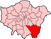
 Green Street Green Green Street Green shown within Greater London | |
| London borough | |
| Ceremonial county | Greater London |
| Region | |
| Country | England |
| Sovereign state | United Kingdom |
| Post town | ORPINGTON |
| Postcode district | BR6 |
| Dialling code | 01689 |
| Police | Metropolitan |
| Fire | London |
| Ambulance | London |
| EU Parliament | London |
| UK Parliament | |
| London Assembly | |
Green Street Green is a village in South East London and is a part of the London Borough of Bromley. It is located south of Orpington. It is within the historic boundaries of Kent and has been administered as part of London since 1965.
Sports Teams
Green Street Green Football Club
Green Street Green Football Club is an Amateur Football Club that plays its home games at Norman Park, Bromley.
Formed in 2009, Green Street Green Football Club competes in the Metropolitan Sunday Football League Division Three.

Place name
The name originates from La Grenestrete c.1290, meaning the green or grassy hamlet. It is recorded as Greenstreet Green in 1819, the addition of the suffix Green, referring to a village green. Green Street Green Primary School is located in the area.[1] The village sign was designed by Stan Mortimer, resident for over 50 years. The village did not historically form a parish of its own, instead forming part of the parishes of Farnborough and Chelsfield.[2]
History
The opening of Oak Brewery by Fox & Sons in 1836 was the first awakening of Green Street Green from a tiny hamlet on the old London to Hastings Road. Village life centered round the brewery until 1909 when it closed down. During the First World War it was used briefly as a barracks. It became the Telcon Plastics factory site before the Second World War. This has now made way for a new housing estate, standing opposite the parade of shops in which Waitrose, arriving in the 1970s, is the main supermarket.
The first modern housing development was at Chelsfield Park in the 1920s. Intensive building, council and private, took place in the 1950s between the village High Street and new Chelsfield. It was during this period that the attractive old people's dwellings were built at Brittenden Close, round three sides of a square lawn with rose gardens and terrace.[3]

In 1947, the Town & Country Planning Act set the boundary of Green belt (United Kingdom) at the Green Street Green edge of the town of Orpington, by the A20 and A21 roads. From the 1920s till the 1960s Green Street Green was such a popular meeting point for cyclists that several tea rooms opened in the village, attracting trade from the hordes of weekend cyclists who rode into the Kent countryside from London's suburbs. The former Mrs Valentine Moon's teashop is still a landmark on the east side of Sevenoaks Road, standing opposite The Green.
Recreation grounds are at Cudham Lane North and at Glentrammon Road.[4]
Buildings
The Anglican parish church is St Mary's Green Street Green. It falls under the parish of Green Street Green and Pratt's Bottom in the diocese of Rochester. It was built in the early 20th century and in the first decade of the 21st century underwent some work on both inside and out to make it more accessible. The church plays an important role in the village, with many of the local schools' governors regularly attending it. The church's creative art group recently created a willow structure, placed on the top of the church, in the shape of a man reaching to the heavens, which has been a large attraction to the church. The vicar is Reverend Karl Carpani.
Green Street Green's Baptist church, know to members as "The Green" is a pivotal part of the local community. It holds youth events such as the popular worship event "Encounter" and does work within the community with the young people from St Mary's Church in an initiative called "Liberation".
Notable residents
- Gary Rhodes
- Eleanor Marx, daughter of Karl Marx
- Thomas Durrant
- Former Italian footballer Gianfranco Zola briefly lived in Julian Road.
Pubs, Restaurants and coffee houses
Green Street Green has a number of pubs, restaurants and coffee houses. The Bombay (Curry House) is an award winning Indian restaurant. Belmondo, situated in the premises formerly occupied by Spoons, is a coffee house offering coffee and sandwiches.
Transport
Green Street Green is served by Transport for London bus routes 358 to Crystal Palace via Bromley and to Orpington, R1 to St Paul's Cray, R5 to Orpington and Knockholt, R8 to Orpington and Biggin Hill, R10 to Orpington and Knockholt, and R11 to Sidcup. It is also served by Go-Coach route 431 to Orpington and to Sevenoaks via Knockholt. The nearest rail link to Green Street Green is at Chelsfield station.
Nearby Areas
Green Street Green borders Orpington to the north and north east, Chelsfield to the east, Pratts Bottom to the south east, Hazelwood to the south, Downe to the south west and Farnborough to the west and north west.
External links
References
- ↑ Mills, A., Dictionary of London Place Names, (2001)
- ↑ Bartholomew, J., Gazetteer of the British Isles, (1887)
- ↑ London Borough of Bromley Official Guide. Published by authority of the Council of the London Borough of Bromley (1971/74)
- ↑ The Book of Orpington. Dorothy Cox, Barracuda Books (1983). ISBN 978-0860234241
See also
There is also a hamlet called Green Street Green in the parish of Bean near Dartford.