Green Island (Okaihe)
| Maori: Okaihe | |
|---|---|
 Green Island | |
| Geography | |
| Location | Dunedin, Otago region |
| Area | 0.04 km2 (0.015 sq mi) |
| Length | 0.3 km (0.19 mi) |
| Width | 0.2 km (0.12 mi) |
| Highest elevation | 42 m (138 ft) |
| Administration | |
|
New Zealand | |
| Demographics | |
| Population | Uninhabited |
Green Island is a small, uninhabited island lying 2 km off the coast of the Otago region of New Zealand, some 13 km south-west of the city of Dunedin. The island's Māori name is Okaihe.
History
Green Island may be the 'Isle of Wight' where the Sydney sealer Brothers, chartered by Robert Campbell and sailing under Robert Mason, dropped eight men of a gang of eleven in November 1809. William Tucker, who later settled at Whareakeake (Murdering Beach) near Otago Heads, was in the gang. Alternatively the 'Isle of Wight' may be Taieri Island, a few kilometres to the south. It has also been suggested that, alternatively, Green Island may be the 'Ragged Rock' where the other three men of the Brothers gang were landed. Some of the men claimed to have stayed on these two islands from 9 November 1809 until 20 December 1810.[1]
Green Island used to be called St Michael's Mount, suggesting it had been named after the island of that name off the Cornish coast. It is more likely it was so named after Tommy Chaseland's mother ship the St Michael when he was sealing there in the 1820s. He told Edward Shortland he lost a boat and all its hands when it was dashed on the island while trying to land. He stayed alone overnight and was picked up by another boat the following day.[2]
In the 1880s the island was mined for guano, bird dung used as fertiliser.
Important Bird Area
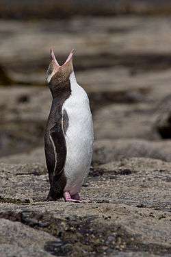
The island has been identified as an Important Bird Area, by BirdLife International because it is home to breeding colonies of yellow-eyed penguins and bronze shags.[3]
See also
References
- ↑ Peter Entwisle, Taka: a Vignette Life of William Tucker 1784-1817, Dunedin, NZ: Port Daniel Press, 2005, p.54 & pp.110-115.
- ↑ Edward Shortland, The Southern Districts of New Zealand; a Journal, London, UK: Longman, Brown, Green & Longmans, 1851 reprinted by Capper Press, Christchurch, 1974, pp.153-4.
- ↑ BirdLife International. (2012). Important Bird Areas factsheet: Gree Island (Okaihe). Downloaded from http://www.birdlife.org on 2012-02-04.
Coordinates: 45°57′11″S 170°23′14″E / 45.95306°S 170.38722°E