Goseck
| Goseck | |
|---|---|
 Goseck Location of Goseck within Burgenlandkreis district 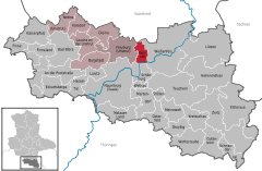  | |
| Coordinates: 51°11′41″N 11°52′18″E / 51.19472°N 11.87167°ECoordinates: 51°11′41″N 11°52′18″E / 51.19472°N 11.87167°E | |
| Country | Germany |
| State | Saxony-Anhalt |
| District | Burgenlandkreis |
| Municipal assoc. | Unstruttal |
| Government | |
| • Mayor | Hilmar Panse |
| Area | |
| • Total | 14.57 km2 (5.63 sq mi) |
| Elevation | 152 m (499 ft) |
| Population (2017-12-31)[1] | |
| • Total | 1,016 |
| • Density | 70/km2 (180/sq mi) |
| Time zone | CET/CEST (UTC+1/+2) |
| Postal codes | 06667 |
| Dialling codes | 03443 |
| Vehicle registration | BLK |
Goseck is a municipality lying on the Saale River, in the Burgenlandkreis district of the German state of Saxony-Anhalt.
Geography
Geographic location
Goseck is located on the north bank of the Saale River about halfway between Naumburg and Weißenfels.
The municipality consists of the settlements Goseck and Markröhlitz.
History
Early period
The first evidence of human settlement is from the Neolithic period, the Goseck circle, dating to approximately the 5th millennium BC, discovered by aerial photographs from the 1990s and, since 2003, regarded as the oldest observatory in Europe. It consists of a circular Henge-construction with a diameter of 75 m. It marks the beginning of a millennia-old astronomical tradition known also from the Nebra skydisk, discovered in 1999, only 25 km distant therefrom. By means of a visor mechanism, the operators were able to, e.g., accurately determine the times of the summer and winter solstice. The reconstructed observatory was opened on the winter solstice, 21 December 2005, with great pageantry, including a spectacular fireworks display.
Modern times
Goseck grew in the fields surrounding the 11th-century monastery St. Mary and St. Michael. Originally an early medieval castle, the Saxon palatial county seat of government was located here. The first mention of the castle is in the Hersfelder Zehnteverzeichnis in 881.
Economics and infrastructure
Traffic
Goseck can be reached by an access road from the area of Markröhlitz, from the Naumburg Highway, running nearby, from Pettstädt onto Bundesstraße 176.
