Good Hope, Alabama
| Good Hope, Alabama | |
|---|---|
| City | |
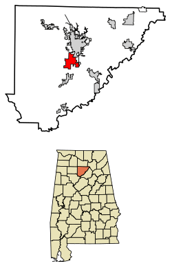 Location of Good Hope in Cullman County, Alabama. | |
| Coordinates: 34°6′31″N 86°52′1″W / 34.10861°N 86.86694°W | |
| Country | United States |
| State | Alabama |
| County | Cullman |
| Area[1] | |
| • Total | 7.95 sq mi (20.60 km2) |
| • Land | 7.91 sq mi (20.48 km2) |
| • Water | 0.05 sq mi (0.12 km2) |
| Elevation | 702 ft (214 m) |
| Population (2010) | |
| • Total | 2,264 |
| • Estimate (2017)[2] | 2,305 |
| • Density | 291.55/sq mi (112.56/km2) |
| Time zone | UTC-6 (Central (CST)) |
| • Summer (DST) | UTC-5 (CDT) |
| FIPS code | 01-30496 |
| GNIS feature ID | 0119108 |
| Website |
goodhopeal |
Good Hope is a city in Cullman County, Alabama, United States. As of the 2010 census, the population of the city was 2,264.[3] It incorporated in April 1962.[4]
Geography
Good Hope is located near the center of Cullman County at 34°6'32" North, 86°52'2" West (34.108777, -86.867164).[5] It is bordered by Cullman, the county seat, to the northeast. Interstate 65 passes through the city, with access from Exit 304. I-65 leads south 45 miles (72 km) to Birmingham and north 57 miles (92 km) (via Interstate 565) to Huntsville.
According to the U.S. Census Bureau, Good Hope has a total area of 8.0 square miles (20.7 km2), of which 8.0 square miles (20.6 km2) is land and 0.04 square miles (0.1 km2), or 0.59%, is water.[3]
Demographics
| Historical population | |||
|---|---|---|---|
| Census | Pop. | %± | |
| 1970 | 840 | — | |
| 1980 | 1,442 | 71.7% | |
| 1990 | 1,700 | 17.9% | |
| 2000 | 1,966 | 15.6% | |
| 2010 | 2,264 | 15.2% | |
| Est. 2017 | 2,305 | [2] | 1.8% |
| U.S. Decennial Census[6] 2013 Estimate[7] | |||
As of the census[8] of 2000, there were 1,966 people, 764 households, and 583 families residing in the city. The population density was 265.0 people per square mile (102.3/km²). There were 864 housing units at an average density of 116.5 per square mile (45.0/km²). The racial makeup of the city was 98.83% White, 0.10% Black or African American, 0.20% Native American, 0.15% Asian, 0.31% from other races, and 0.41% from two or more races. 1.12% of the population were Hispanic or Latino of any race.
There were 764 households out of which 35.5% had children under the age of 18 living with them, 62.2% were married couples living together, 11.0% had a female householder with no husband present, and 23.6% were non-families. 20.8% of all households were made up of individuals and 6.3% had someone living alone who was 65 years of age or older. The average household size was 2.57 and the average family size was 2.98.
In the city, the population was spread out with 25.6% under the age of 18, 9.7% from 18 to 24, 30.7% from 25 to 44, 22.6% from 45 to 64, and 11.3% who were 65 years of age or older. The median age was 35 years. For every 100 females, there were 96.8 males. For every 100 females age 18 and over, there were 95.7 males.
The median income for a household in the city was $33,274, and the median income for a family was $39,063. Males had a median income of $25,809 versus $20,762 for females. The per capita income for the city was $16,602. 7.0% of the population and 5.1% of families were below the poverty line. 5.7% of those under the age of 18 and 13.9% of those 65 and older were living below the poverty line.
2010 census
As of the census[9] of 2010, there were 2,264 people, 847 households, and 631 families residing in the town. The population density was 285 people per square mile (110.2/km²). There were 932 housing units at an average density of 116.5 per square mile (45.0/km²). The racial makeup of the city was 92.7% White, 0.3% Black or African American, 0.4% Native American, 0.5% Asian, 5.2% from other races, and 1.1% from two or more races. 7.7% of the population were Hispanic or Latino of any race.
There were 847 households out of which 34.2% had children under the age of 18 living with them, 57.3% were married couples living together, 12.4% had a female householder with no husband present, and 25.5% were non-families. 22.2% of all households were made up of individuals and 8.1% had someone living alone who was 65 years of age or older. The average household size was 2.67 and the average family size was 3.12.
In the city, the population was spread out with 26.9% under the age of 18, 8.5% from 18 to 24, 26.9% from 25 to 44, 24.6% from 45 to 64, and 13.1% who were 65 years of age or older. The median age was 36.5 years. For every 100 females, there were 101.2 males. For every 100 females age 18 and over, there were 100.0 males.
The median income for a household in the city was $45,784, and the median income for a family was $48,080. Males had a median income of $50,750 versus $27,865 for females. The per capita income for the city was $22,771. 19.3% of the population and 13.7% of families were below the poverty line. 29.7% of those under the age of 18 and 21.4% of those 65 and older were living below the poverty line.
Education
- Good Hope Primary School- Grades PK-2.
- Good Hope Elementary School- Grades 3-5.
- Good Hope Middle School- Grades 6-8.
- Good Hope High School- serves 395 students in grades 9-12. Its mascot is the Raiders, and its school colors are red and white. Its sports teams are part of the Alabama High School Athletic Association Class 4A.
All four schools are members of the Cullman County Board of Education.
References
- ↑ "2017 U.S. Gazetteer Files". United States Census Bureau. Retrieved Jul 7, 2018.
- 1 2 "Population and Housing Unit Estimates". Retrieved March 24, 2018.
- 1 2 "Geographic Identifiers: 2010 Demographic Profile Data (G001): City of Good Hope, Alabama". U.S. Census Bureau, American Factfinder. Retrieved June 11, 2014.
- ↑ http://www.encyclopediaofalabama.org/article/h-3308
- ↑ "US Gazetteer files: 2010, 2000, and 1990". United States Census Bureau. 2011-02-12. Retrieved 2011-04-23.
- ↑ "U.S. Decennial Census". Census.gov. Archived from the original on May 12, 2015. Retrieved June 6, 2013.
- ↑ "Annual Estimates of the Resident Population: April 1, 2010 to July 1, 2013". Archived from the original on May 22, 2014. Retrieved June 3, 2014.
- ↑ "American FactFinder". United States Census Bureau. Archived from the original on 2013-09-11. Retrieved 2008-01-31.
- ↑ "American FactFinder". United States Census Bureau. Archived from the original on 2013-09-11. Retrieved 2015-07-20.
External links
Coordinates: 34°06′32″N 86°52′02″W / 34.108777°N 86.867164°W
Municipalities and communities of Cullman County, Alabama, United States | ||
|---|---|---|
| Cities | 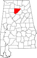 | |
| Towns | ||
| CDPs | ||
| Unincorporated communities | ||
| Footnotes | ‡This populated place also has portions in an adjacent county or counties | |