Fairview, Alabama
| Fairview, Alabama | |
|---|---|
| Town | |
 Location of Fairview in Cullman County, Alabama. | |
| Coordinates: 34°14′55″N 86°41′15″W / 34.24861°N 86.68750°W | |
| Country | United States |
| State | Alabama |
| County | Cullman |
| Area[1] | |
| • Total | 2.72 sq mi (7.05 km2) |
| • Land | 2.71 sq mi (7.01 km2) |
| • Water | 0.01 sq mi (0.04 km2) |
| Elevation | 938 ft (286 m) |
| Population (2010) | |
| • Total | 446 |
| • Estimate (2017)[2] | 459 |
| • Density | 169.50/sq mi (65.45/km2) |
| Time zone | UTC-6 (Central (CST)) |
| • Summer (DST) | UTC-5 (CDT) |
| FIPS code | 01-25384 |
| GNIS feature ID | 0118132 |
Fairview is a town in Cullman County, Alabama, United States. At the 2010 census the population was 446,[3] down from 522 in 2000. It incorporated in 1968.
Geography
Fairview is located in northeastern Cullman County at 34°14′55″N 86°41′16″W / 34.24861°N 86.68778°W (34.248717, -86.687761).[4]
According to the U.S. Census Bureau, the town has a total area of 2.7 square miles (7.1 km2), of which 0.015 square miles (0.04 km2), or 0.57%, is water.[3]
Demographics
| Historical population | |||
|---|---|---|---|
| Census | Pop. | %± | |
| 1970 | 313 | — | |
| 1980 | 450 | 43.8% | |
| 1990 | 383 | −14.9% | |
| 2000 | 522 | 36.3% | |
| 2010 | 446 | −14.6% | |
| Est. 2017 | 459 | [2] | 2.9% |
| U.S. Decennial Census[5] 2013 Estimate[6] | |||
As of the census[7] of 2000, there were 522 people, 188 households, and 144 families residing in the town. The population density was 212.1 people per square mile (81.9/km²). There were 198 housing units at an average density of 80.4 per square mile (31.1/km²). The racial makeup of the town was 86.59% White, 0.77% Native American, 0.19% Asian, 7.28% from other races, and 5.17% from two or more races. 16.28% of the population were Hispanic or Latino of any race.
There were 188 households out of which 36.7% had children under the age of 18 living with them, 57.4% were married couples living together, 8.0% had a female householder with no husband present, and 23.4% were non-families. 20.7% of all households were made up of individuals and 11.7% had someone living alone who was 65 years of age or older. The average household size was 2.78 and the average family size was 3.06.
In the town, the population was spread out with 23.4% under the age of 18, 13.8% from 18 to 24, 30.5% from 25 to 44, 17.6% from 45 to 64, and 14.8% who were 65 years of age or older. The median age was 33 years. For every 100 females, there were 125.0 males. For every 100 females age 18 and over, there were 126.0 males.
The median income for a household in the town was $31,875, and the median income for a family was $37,500. Males had a median income of $21,944 versus $21,042 for females. The per capita income for the town was $13,817. About 13.0% of families and 14.8% of the population were below the poverty line, including 26.0% of those under age 18 and 11.6% of those age 65 or over.
Education
- Fairview Elementary School (K-5)
- Fairview Middle School (6-8)
- Fairview High School (9-12)
All three schools are members of the Cullman County Board of Education.
In popular culture
In 2004, the dramatic film Lightning Bug was shot on location in Fairview. It was the debut film by writer/director Robert Green Hall, a special-effects makeup artist known primarily for his work on the TV series Buffy the Vampire Slayer.
References
- ↑ "2017 U.S. Gazetteer Files". United States Census Bureau. Retrieved Jul 7, 2018.
- 1 2 "Population and Housing Unit Estimates". Retrieved March 24, 2018.
- 1 2 "Geographic Identifiers: 2010 Demographic Profile Data (G001): Fairview town, Alabama". U.S. Census Bureau, American Factfinder. Retrieved June 11, 2014.
- ↑ "US Gazetteer files: 2010, 2000, and 1990". United States Census Bureau. 2011-02-12. Retrieved 2011-04-23.
- ↑ "U.S. Decennial Census". Census.gov. Archived from the original on May 12, 2015. Retrieved June 6, 2013.
- ↑ "Annual Estimates of the Resident Population: April 1, 2010 to July 1, 2013". Archived from the original on May 22, 2014. Retrieved June 3, 2014.
- ↑ "American FactFinder". United States Census Bureau. Archived from the original on 2013-09-11. Retrieved 2008-01-31.
Coordinates: 34°14′55″N 86°41′16″W / 34.248717°N 86.687761°W
Municipalities and communities of Cullman County, Alabama, United States | ||
|---|---|---|
| Cities | 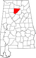 | |
| Towns | ||
| CDPs | ||
| Unincorporated communities | ||
| Footnotes | ‡This populated place also has portions in an adjacent county or counties | |