Black Bottom, Alabama
| Black Bottom, Alabama | |
|---|---|
| Unincorporated community | |
 Black Bottom, Alabama  Black Bottom, Alabama | |
| Coordinates: 33°56′53″N 86°51′36″W / 33.94806°N 86.86000°WCoordinates: 33°56′53″N 86°51′36″W / 33.94806°N 86.86000°W | |
| Country | United States |
| State | Alabama |
| County | Cullman |
| Elevation | 322 ft (98 m) |
| Time zone | UTC-6 (Central (CST)) |
| • Summer (DST) | UTC-5 (CDT) |
| Area code(s) | 256 & 938 |
| GNIS feature ID | 114396[1] |
Black Bottom is an unincorporated community in Cullman County, Alabama, United States, located near the junction of Interstate 65 and Alabama State Route 91, 2.4 miles (3.9 km) east of Colony.[2]
Black Bottom has been noted for its unusual place name.[3]
References
- ↑ "Black Bottom". Geographic Names Information System. United States Geological Survey.
- ↑ Cullman County, Alabama General Highway Map (PDF) (Map). Alabama Department of Transportation. 2007. Archived from the original (PDF) on 2014-02-21. Retrieved March 19, 2012.
- ↑ Thompson, George E. (1 July 2009). You Live Where?: Interesting and Unusual Facts about where We Live. iUniverse. p. 1. ISBN 978-1-4401-3421-0.
Municipalities and communities of Cullman County, Alabama, United States | ||
|---|---|---|
| Cities | 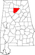 | |
| Towns | ||
| CDPs | ||
| Unincorporated communities | ||
| Footnotes | ‡This populated place also has portions in an adjacent county or counties | |
This article is issued from
Wikipedia.
The text is licensed under Creative Commons - Attribution - Sharealike.
Additional terms may apply for the media files.