Golestan, Iran
| Golestan گلستان | |
|---|---|
| City | |
 Golestan | |
| Coordinates: 35°46′33″N 51°28′20″E / 35.77583°N 51.47222°ECoordinates: 35°46′33″N 51°28′20″E / 35.77583°N 51.47222°E | |
| Country |
|
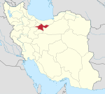
| Province | Tehran |
| County | Baharestan |
| Bakhsh | Golestan |
| Population (2016 Census) | |
| • Urban | 239,556 [1] |
| Time zone | UTC+3:30 (IRST) |
| • Summer (DST) | UTC+4:30 (IRDT) |
Golestan (Persian: گلستان, also Romanized as Golestān)[2] is a city and capital of Golestan District, Baharestan County, Tehran Province, Iran. At the 2006 census, its population was 231,882, in 57,216 families.[3]
Climate
Köppen-Geiger climate classification system classifies its climate as cold semi-arid (BSk).[4] In summer, its average temperatures are cooler than that of Tehran city, so as its average winter temperatures are colder.
| Climate data for Golestan | |||||||||||||
|---|---|---|---|---|---|---|---|---|---|---|---|---|---|
| Month | Jan | Feb | Mar | Apr | May | Jun | Jul | Aug | Sep | Oct | Nov | Dec | Year |
| Average high °C (°F) | 5.3 (41.5) |
7 (45) |
11.3 (52.3) |
17.9 (64.2) |
24 (75) |
29.1 (84.4) |
31.3 (88.3) |
31.6 (88.9) |
27.6 (81.7) |
21.3 (70.3) |
14.8 (58.6) |
8.3 (46.9) |
19.1 (66.4) |
| Daily mean °C (°F) | −0.8 (30.6) |
1.5 (34.7) |
5.2 (41.4) |
11.3 (52.3) |
16.8 (62.2) |
20.9 (69.6) |
23.3 (73.9) |
23 (73) |
18.7 (65.7) |
12.9 (55.2) |
7.4 (45.3) |
2.6 (36.7) |
11.9 (53.4) |
| Average low °C (°F) | −6.8 (19.8) |
−3.9 (25) |
−0.8 (30.6) |
4.7 (40.5) |
9.6 (49.3) |
12.8 (55) |
15.3 (59.5) |
14.4 (57.9) |
9.8 (49.6) |
4.5 (40.1) |
0 (32) |
−3 (27) |
4.7 (40.5) |
| Average precipitation mm (inches) | 28 (1.1) |
33 (1.3) |
53 (2.09) |
50 (1.97) |
32 (1.26) |
7 (0.28) |
1 (0.04) |
1 (0.04) |
2 (0.08) |
14 (0.55) |
17 (0.67) |
20 (0.79) |
258 (10.17) |
| Source: Climate-Data.org, altitude: 1238m[4] | |||||||||||||
References
- ↑ https://www.amar.org.ir/english
- ↑ Golestan, Iran can be found at GEOnet Names Server, at this link, by opening the Advanced Search box, entering "232651" in the "Unique Feature Id" form, and clicking on "Search Database".
- ↑ "Census of the Islamic Republic of Iran, 1385 (2006)". Islamic Republic of Iran. Archived from the original (Excel) on 2011-11-11.
- 1 2 "Climate: Golestan - Climate graph, Temperature graph, Climate table". Climate-Data.org. Retrieved 9 September 2013.
| Capital | |||||||||||||||||||||
|---|---|---|---|---|---|---|---|---|---|---|---|---|---|---|---|---|---|---|---|---|---|
| Districts |
| ||||||||||||||||||||
This article is issued from
Wikipedia.
The text is licensed under Creative Commons - Attribution - Sharealike.
Additional terms may apply for the media files.