Firuzkuh County
| Firuzkuh County شهرستان فیروزکوه | |
|---|---|
| County (Shahrestan) | |
 Tang e Vashi, in the county | |
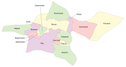 Counties of Tehran Province | |
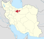
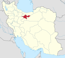 Location of Tehran Province in Iran | |
| Coordinates: 35°44′N 52°45′E / 35.733°N 52.750°ECoordinates: 35°44′N 52°45′E / 35.733°N 52.750°E | |
| Country |
|
| Province | Tehran |
| Capital | Firuzkuh |
| Bakhsh (Districts) | Central District, Arjomand District |
| Area | |
| • Total | 2,386 km2 (921 sq mi) |
| Population (2016)(Census, provisional) | |
| • Total | 33,558 |
| • Density | 14.06/km2 (36.4/sq mi) |
| Time zone | UTC+3:30 (IRST) |
| • Summer (DST) | UTC+4:30 (IRDT) |
| Firuzkuh County can be found at GEOnet Names Server, at this link, by opening the Advanced Search box, entering "9206116" in the "Unique Feature Id" form, and clicking on "Search Database". | |
Firuzkuh County (Persian: شهرستان فیروزکوه) is a county (shahrestan) in Tehran Province of Iran. It has an area of 2,386 km2. The administrative centre of the county is the city of Firuzkuh. At the 2011 census, the county's population was 38,712, but the provisional results of the 2016 showed a decline to 33,558.[1] The county is subdivided into two districts: the Central District and Arjomand District. The county has two cities: Firuzkuh and Arjomand.
References
- ↑ Statistical Centre of Iran (web).
- اطلس گیتاشناسی استانهای ایران [Atlas Gitashenasi Ostanhai Iran] (Gitashenasi Province Atlas of Iran)
| Capital | |||||||||||||||||||||||
|---|---|---|---|---|---|---|---|---|---|---|---|---|---|---|---|---|---|---|---|---|---|---|---|
| Districts |
| ||||||||||||||||||||||
External links
| Wikimedia Commons has media related to iruzkuh county. |
This article is issued from
Wikipedia.
The text is licensed under Creative Commons - Attribution - Sharealike.
Additional terms may apply for the media files.