Glenlyon, Queensland
| Glenlyon Queensland | |||||||||||||||
|---|---|---|---|---|---|---|---|---|---|---|---|---|---|---|---|
 Glenlyon | |||||||||||||||
| Coordinates | 28°55′10″S 151°27′08″E / 28.9194°S 151.4522°ECoordinates: 28°55′10″S 151°27′08″E / 28.9194°S 151.4522°E | ||||||||||||||
| Area | 402.9 km2 (155.6 sq mi) | ||||||||||||||
| LGA(s) | Southern Downs Region | ||||||||||||||
| State electorate(s) | Southern Downs | ||||||||||||||
| Federal Division(s) | Maranoa | ||||||||||||||
| |||||||||||||||
Glenlyon is a locality in the Southern Downs Region, Queensland, Australia.[1]
History
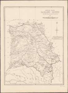
1883 map of the Darling Downs showing pastoral runs
The locality's name is derived from Glenlyon pastoral run taken up in 1844 by Alexander McLeod. The run can be seen on an 1883 Darling Downs Run Map on Pikes Creek, south of Pikes Creek run.[1] In 1996 Scott McLeod Walker, a great grandson of Alexander McLeod, privately wrote and published a book entitled Glenlyon Connections. The book contains a history of the pastoral run and of some of the families who owned it[2].
References
- 1 2 "Glenlyon - locality in Southern Downs Region (entry 46010)". Queensland Place Names. Queensland Government. Retrieved 8 November 2017.
- ↑ Scott McLeod Walker: Glenlyon Connections: ISBN 0 646 13431: published 1996
This article is issued from
Wikipedia.
The text is licensed under Creative Commons - Attribution - Sharealike.
Additional terms may apply for the media files.