Gibson Lake (Nipissing District)
| Gibson Lake | |
|---|---|
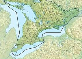 Gibson Lake Location in southern Ontario | |
| Location | Nipissing District, Ontario |
| Coordinates | 45°52′44″N 78°55′10″W / 45.87889°N 78.91944°WCoordinates: 45°52′44″N 78°55′10″W / 45.87889°N 78.91944°W[1] |
| Type | Lake |
| Part of | Saint Lawrence River drainage basin |
| Primary outflows | Gibson Creek |
| Basin countries | Canada |
| Max. length | 3.4 kilometres (2.1 mi) |
| Max. width | 1.0 metre (0.0 mi) |
| Surface elevation | 416 metres (1,365 ft)[2] |
Gibson Lake is a lake in geographic Biggar Township, Nipissing District in Northeastern Ontario, Canada.[1] It is in the Saint Lawrence River drainage basin and lies within Algonquin Provincial Park. The major outflow, at the southwest, is Gibson Creek which flows to the Nipissing River, and then via the Petawawa River and the Ottawa River to the Saint Lawrence River.
See also
References
- 1 2 "Gibson Lake". Geographical Names Data Base. Natural Resources Canada. Retrieved 2014-12-18.
- ↑ Taken from Google Earth at geographic coordinates, accessed 2014-12-18.
Other map sources:
- Map 19 (PDF) (Map). 1 : 700,000. Official road map of Ontario. Ministry of Transportation of Ontario. 2014. Retrieved 2014-12-18.
- Restructured municipalities - Ontario map #5 (Map). Restructuring Maps of Ontario. Ontario Ministry of Municipal Affairs and Housing. 2006. Retrieved 2014-12-18.
- McMurtrie, Jeffrey (2008). "Algonquin Provincial Park and the Haliburton Highlands". Wikimedia Commons. Archived from the original on 2011-06-29. Retrieved 2014-12-18.
This article is issued from
Wikipedia.
The text is licensed under Creative Commons - Attribution - Sharealike.
Additional terms may apply for the media files.