Georgetown, Maryland
| Georgetown, Maryland | |
|---|---|
| Unincorporated community | |
 Georgetown | |
| Coordinates: 39°21′42″N 75°52′49″W / 39.36167°N 75.88028°WCoordinates: 39°21′42″N 75°52′49″W / 39.36167°N 75.88028°W | |
| Country | United States |
| State | Maryland |
| County | Cecil and Kent |
| Elevation | 33 ft (10 m) |
| Time zone | UTC-5 (Eastern (EST)) |
| • Summer (DST) | UTC-4 (EDT) |
| ZIP code | 21930 |
| Area code(s) | 410, 443, and 667 |
| GNIS feature ID | 590291[1] |
Georgetown is an unincorporated community in Cecil and Kent counties in Maryland, United States.[1] Georgetown is located at the point Maryland Route 213 crosses the Sassafras River, which forms the county line, north of Galena and south of Cecilton.
The Nellie Crockett (Buy-Boat) and Valley Cottage are listed on the National Register of Historic Places.[2]
References
- 1 2 "Georgetown". Geographic Names Information System. United States Geological Survey.
- ↑ National Park Service (2010-07-09). "National Register Information System". National Register of Historic Places. National Park Service.
Municipalities and communities of Cecil County, Maryland, United States | ||
|---|---|---|
| Towns | 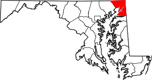 | |
| Unincorporated communities |
| |
| Ghost town | ||
| Footnotes | ‡This populated place also has portions in an adjacent county or counties | |
Municipalities and communities of Kent County, Maryland, United States | ||
|---|---|---|
| Towns | 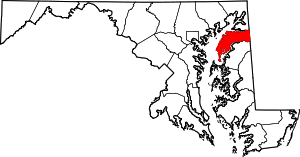 | |
| CDPs | ||
| Unincorporated communities | ||
| Footnotes | ‡This populated place also has portions in an adjacent county or counties | |
This article is issued from
Wikipedia.
The text is licensed under Creative Commons - Attribution - Sharealike.
Additional terms may apply for the media files.