Earleville, Maryland
| Earleville, Maryland | |
|---|---|
| Unincorporated community | |
 Earleville Location within the state of Maryland  Earleville Earleville (the US) | |
| Coordinates: 39°24′55″N 75°55′03″W / 39.41528°N 75.91750°WCoordinates: 39°24′55″N 75°55′03″W / 39.41528°N 75.91750°W | |
| Country | United States |
| State | Maryland |
| County | Cecil |
| Elevation | 85 ft (26 m) |
| Time zone | UTC-5 (Eastern (EST)) |
| • Summer (DST) | UTC-4 (EDT) |
| ZIP code | 21919 |
| Area code(s) | 410, 443, and 667 |
| GNIS feature ID | 584214[1] |
Earleville is an unincorporated community in Cecil County, Maryland, United States.[1] Earleville is located at the intersection of Maryland Route 282 and Grove Neck Road west of Cecilton.
Located at Earleville and listed on the National Register of Historic Places are: Bohemia Farm, Mount Harmon, Rose Hill, and St. Stephen's Episcopal Church.[2]
References
- 1 2 "Earleville". Geographic Names Information System. United States Geological Survey.
- ↑ National Park Service (2008-04-15). "National Register Information System". National Register of Historic Places. National Park Service.
External links
Municipalities and communities of Cecil County, Maryland, United States | ||
|---|---|---|
| Towns | 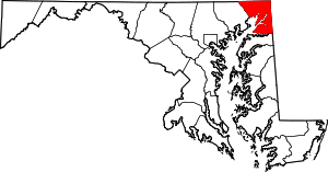 | |
| Unincorporated communities |
| |
| Ghost town | ||
| Footnotes | ‡This populated place also has portions in an adjacent county or counties | |
This article is issued from
Wikipedia.
The text is licensed under Creative Commons - Attribution - Sharealike.
Additional terms may apply for the media files.