Twenterand
| Twenterand | |||
|---|---|---|---|
| Municipality | |||
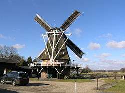 Windmill in Vriezenveen | |||
| |||
.svg.png) Location in Overijssel | |||
| Coordinates: 52°25′N 6°38′E / 52.417°N 6.633°ECoordinates: 52°25′N 6°38′E / 52.417°N 6.633°E | |||
| Country | Netherlands | ||
| Province | Overijssel | ||
| Established | 1 January 2001[1] | ||
| Renamed | 1 January 2003[2] | ||
| Government[3] | |||
| • Body | Municipal council | ||
| • Mayor | Annelies van der Kolk (acting) (CU) | ||
| Area[4] | |||
| • Total | 108.14 km2 (41.75 sq mi) | ||
| • Land | 106.32 km2 (41.05 sq mi) | ||
| • Water | 1.82 km2 (0.70 sq mi) | ||
| Elevation[5] | 10 m (30 ft) | ||
| Population (August 2017)[6] | |||
| • Total | 33,906 | ||
| • Density | 319/km2 (830/sq mi) | ||
| Time zone | UTC+1 (CET) | ||
| • Summer (DST) | UTC+2 (CEST) | ||
| Postcode | 7670–7677, 7680–7683 | ||
| Area code | 0546 | ||
| Website |
www | ||

Twenterand [ˈtʋɛntərɑnt] (![]()
The municipality of Twenterand also had two city halls, because of the merger between the former municipalities of Vriezenveen and Den Ham in 2001. The city hall in Vriezenveen remained. The extended municipality of Vriezenveen is called Twenterand since 2003. The former municipal area of Vriezenveen belongs to the region of Twente and the former municipal area of Den Ham partly to the region of Salland and partly to the region of Twente.
Population centres
- Bruinehaar
- De Pollen
- Den Ham
- Geerdijk
- Kloosterhaar
- Meer
- Vriezenveen
- Vroomshoop
- Weitemanslanden
- Westerhaar-Vriezenveensewijk
- Westerhoeven

Dutch topographic map of the municipality of Twenterand, June 2015
Transportation
References
- ↑ "Gemeentelijke indeling op 1 januari 2001" [Municipal divisions on 1 January 2001]. cbs.nl (in Dutch). CBS. Retrieved 2 April 2014.
- ↑ "Gemeentelijke indeling op 1 januari 2003" [Municipal divisions on 1 January 2003]. cbs.nl (in Dutch). CBS. Retrieved 2 April 2014.
- ↑ "Collegeleden" [Members of the board] (in Dutch). Gemeente Twenterand. Archived from the original on 7 April 2014. Retrieved 2 April 2014.
- ↑ "Kerncijfers wijken en buurten" [Key figures for neighbourhoods]. CBS Statline (in Dutch). CBS. 2 July 2013. Retrieved 12 March 2014.
- ↑ "Postcodetool for 7671GS". Actueel Hoogtebestand Nederland (in Dutch). Het Waterschapshuis. Retrieved 2 April 2014.
- ↑ "Bevolkingsontwikkeling; regio per maand" [Population growth; regions per month]. CBS Statline (in Dutch). CBS. 27 October 2017. Retrieved 27 October 2017.
External links

- Official website
Places adjacent to Twenterand | ||||||||||
|---|---|---|---|---|---|---|---|---|---|---|
| ||||||||||
Municipalities of Overijssel | ||
|---|---|---|
 | ||
| ||
This article is issued from
Wikipedia.
The text is licensed under Creative Commons - Attribution - Sharealike.
Additional terms may apply for the media files.