Rijssen-Holten
| Rijssen-Holten | ||
|---|---|---|
| Municipality | ||
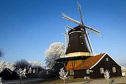 Windmill in Rijssen | ||
| ||
.svg.png) Location in Overijssel | ||
| Coordinates: 52°18′N 6°31′E / 52.300°N 6.517°ECoordinates: 52°18′N 6°31′E / 52.300°N 6.517°E | ||
| Country | Netherlands | |
| Province | Overijssel | |
| Established | 1 January 2001[1] | |
| Renamed | 1 January 2004[2] | |
| Government[3] | ||
| • Body | Municipal council | |
| • Mayor | Arco Hofland (CDA) | |
| Area[4] | ||
| • Total | 94.38 km2 (36.44 sq mi) | |
| • Land | 94.13 km2 (36.34 sq mi) | |
| • Water | 0.25 km2 (0.10 sq mi) | |
| Elevation[5] | 14 m (46 ft) | |
| Population (August 2017)[6] | ||
| • Total | 38,064 | |
| • Density | 404/km2 (1,050/sq mi) | |
| Time zone | UTC+1 (CET) | |
| • Summer (DST) | UTC+2 (CEST) | |
| Postcode | 7450–7463 | |
| Area code | 0548 | |
| Website |
www | |
Rijssen-Holten (![]()
The municipality was formed in 2001 by the joining of the municipalities of Holten and Rijssen. The area of Holten belongs to the region of Salland and the area of Rijssen to the region of Twente.
Population centres
- Beuseberg,
- De Borkeld,
- Dijkerhoek (2 km west of Holten),
- Espelo,
- Holten,
- Holterbroek,
- Lichtenberg,
- Look,
- Neerdorp (currently a part of the village Holten)
- Rijssen
Only Holten and Rijssen have over 500 inhabitants.
Topography

Dutch Topographic map of the municipality of Rijssen-Holten, June 2015
Accessibility
Both Holten and Rijssen are easily accessible by car; the A1 motorway (Amsterdam - Berlin) is only a few kilometres away. The distance between Amsterdam and Holten is about 110 km (68 mi). Rijssen lies 7 km (4.3 mi) more to the east.
References
- ↑ "Gemeentelijke indeling op 1 januari 2001" [Municipal divisions on 1 January 2001]. cbs.nl (in Dutch). CBS. Retrieved 1 April 2014.
- ↑ "Gemeentelijke indeling op 1 januari 2004" [Municipal divisions on 1 January 2004]. cbs.nl (in Dutch). CBS. Retrieved 1 April 2014.
- ↑ "College samenstelling" [Members of the board] (in Dutch). Gemeente Rijssen-Holten. Archived from the original on 1 April 2014. Retrieved 1 April 2014.
- ↑ "Kerncijfers wijken en buurten" [Key figures for neighbourhoods]. CBS Statline (in Dutch). CBS. 2 July 2013. Retrieved 12 March 2014.
- ↑ "Postcodetool for 7461DD". Actueel Hoogtebestand Nederland (in Dutch). Het Waterschapshuis. Retrieved 1 April 2014.
- ↑ "Bevolkingsontwikkeling; regio per maand" [Population growth; regions per month]. CBS Statline (in Dutch). CBS. 27 October 2017. Retrieved 27 October 2017.
External links

- Official website
Places adjacent to Rijssen-Holten | ||||||||||
|---|---|---|---|---|---|---|---|---|---|---|
| ||||||||||
Municipalities of Overijssel | ||
|---|---|---|
 | ||
| ||
This article is issued from
Wikipedia.
The text is licensed under Creative Commons - Attribution - Sharealike.
Additional terms may apply for the media files.