Steenwijkerland
| Steenwijkerland | |||
|---|---|---|---|
| Municipality | |||
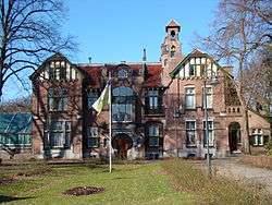 Monumental house in Steenwijk | |||
| |||
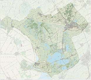
.svg.png) Location in Overijssel | |||
| Coordinates: 52°47′N 6°7′E / 52.783°N 6.117°ECoordinates: 52°47′N 6°7′E / 52.783°N 6.117°E | |||
| Country | Netherlands | ||
| Province |
| ||
| Established | 1 January 2001[1] | ||
| Renamed | 1 January 2003[2] | ||
| Government[3] | |||
| • Body | Municipal council | ||
| • Mayor | Rob Bats (VVD) | ||
| Area[4] | |||
| • Total | 321.59 km2 (124.17 sq mi) | ||
| • Land | 290.16 km2 (112.03 sq mi) | ||
| • Water | 31.43 km2 (12.14 sq mi) | ||
| Elevation[5] | 5 m (16 ft) | ||
| Population (August 2017)[6] | |||
| • Total | 43,671 | ||
| • Density | 151/km2 (390/sq mi) | ||
| Time zone | UTC+1 (CET) | ||
| • Summer (DST) | UTC+2 (CEST) | ||
| Postcode | Parts of 7000 and 8000 ranges | ||
| Area code | Various | ||
| Website |
www | ||

Steenwijkerland (![]()
The municipality forms the entire northwesterly corner of the province. This area is called "the Head of Overijssel" (in Dutch: de Kop van Overijssel). It borders the province Friesland. The seat of the municipality, Steenwijk, with a population of about 17,100, is situated on the A32 motorway (Zwolle – Meppel – Leeuwarden) and has a railway station on the line connecting those same cities.
Economy
Steenwijk is the economic and administrative centre of the region. Many smaller trading and industrial enterprises are housed here, as well as a hospital and some secondary schools.
Vollenhove has a shipyard, where very exclusive yachts are built.
All over the area, partially being below sea level, the soil is somewhat swampy. Many Steenwijkerland farmers only raise cattle. The soil is too wet to grow corn or wheat. However, the wetlands also have an advantage: many nature- or water sports-loving tourists come to the municipality.
Population centres
The larger places are printed in bold type. In brackets: estimated population, on 1 January 2006.
- Baarlo
- Baars
- Barsbeek
- Basse
- Belt-Schutsloot
- Blauwe Hand
- Blokzijl (1,400)
- De Bult
- De Klosse
- De Kolk
- De Pol
- Doosje
- Dwarsgracht – like Nederland and Muggenbeet, a small village much like Giethoorn, however more remote
- Eesveen
- Giethoorn (2,600)
- Heetveld
- Kadoelen
- Kalenberg
- Kallenkote
- Kuinre
- Leeuwte
- Marijenkampen
- Moespot
- Muggenbeet
- Nederland, Overijssel
- Oldemarkt (2,600)
- Onna, Overijssel
- Ossenzijl
- Paasloo
- Roekebosch
- Ronduite
- Scheerwolde
- Sint Jansklooster (2,400)
- Steenwijk (17,100)
- Steenwijkerwold (1,900)
- Tuk – like Zuidveen now a suburb of Steenwijk (1,600)
- Vollenhove (4,100)
- Wanneperveen (1,600)
- Wetering
- Willemsoord
- Witte Paarden
- Zuidveen
Sights
- The city of Steenwijk can be visited for daily shopping, going to the market, etc. Don't expect exclusive or extremely "trendy" shops!
- In Steenwijk the villa "Ramswoerthe", built in 1899 in Jugendstil architecture, and its park can be visited.
- Blokzijl has a small marina, surrounded by picturesque old brick houses from the 17th century, looking like miniatures of the Amsterdam canal houses.
- Vollenhove has two remarkable old churches (15th and 17th century), the castle ruins of Toutenburg with a park, the estate Old Ruitenborgh (18th century; small hotel with a good restaurant) and several old houses, of which the former Latin School (17th century) is the most beautiful.
- Giethoorn and Dwarsgracht are picturesque due to their local structure (see above); many of the old farmhouses have been transformed into "second homes" where rich Dutchmen live during their holidays. In summer, most houses of the village are lit in the evening, which enables the Tourist Board to organise romantic guided boat tours. Of course, a yacht-basin, restaurants and camping sites are there as well.
- Between Kuinre and Steenwijk lies the National Park "De Weerribben", a very valuable wetland area with bogs, swamps, small canals and meadows. It can be visited on guided tours. The entrance is in Ossenzijl. For information ask the VVV (Tourist Board) or the owner, the "Natuurmonumenten" organization (on their website, type under: Zoeken ( = Search) the name of the area).
- A similar natural reserve called "De Wieden" is situated in the southern part of the municipality. An information centre is situated in St. Jansklooster near Vollenhove. "Wieden" means: wide places, wide lakes. These lakes are suitable for sailing, windsurfing etc.
References
- ↑ "Gemeentelijke indeling op 1 januari 2001" [Municipal divisions on 1 January 2001]. cbs.nl (in Dutch). CBS. Retrieved 1 April 2014.
- ↑ "Gemeentelijke indeling op 1 januari 2003" [Municipal divisions on 1 January 2003]. cbs.nl (in Dutch). CBS. Retrieved 1 April 2014.
- ↑ "Burgemeester M.A.J. van der Tas (Marja) (CDA)" [Mayor M.A.J. van der Tas (Marja) (CDA)] (in Dutch). Gemeente Steenwijkerland. Archived from the original on 14 July 2014. Retrieved 1 April 2014.
- ↑ "Kerncijfers wijken en buurten" [Key figures for neighbourhoods]. CBS Statline (in Dutch). CBS. 2 July 2013. Retrieved 12 March 2014.
- ↑ "Postcodetool for 8331XE". Actueel Hoogtebestand Nederland (in Dutch). Het Waterschapshuis. Retrieved 1 April 2014.
- ↑ "Bevolkingsontwikkeling; regio per maand" [Population growth; regions per month]. CBS Statline (in Dutch). CBS. 27 October 2017. Retrieved 27 October 2017.
External links

- Official website
Places adjacent to Steenwijkerland | ||||||||||
|---|---|---|---|---|---|---|---|---|---|---|
| ||||||||||
Municipalities of Overijssel | ||
|---|---|---|
 | ||
| ||