Gaspee Point
|
Gaspee Point | |
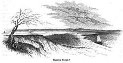 Gaspee Point in 1852 | |
  | |
| Location | Warwick, Rhode Island |
|---|---|
| Coordinates | 41°44′40″N 71°22′42″W / 41.74444°N 71.37833°WCoordinates: 41°44′40″N 71°22′42″W / 41.74444°N 71.37833°W |
| Built | 1772 |
| NRHP reference # | 72000018 [1] |
| Added to NRHP | June 8, 1972 |
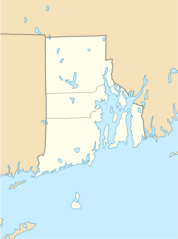
Gaspee Point is a small peninsula on the west side of the southern reaches of the Providence River in Warwick, Rhode Island. It is bounded on the north by Passeonkquis Cove and on the south by Occupessatuxet Cove. It is reached via Namquid Drive in Warwick.
Gaspee Point was the site of one of the first acts of hostility in the American Revolution when the British Royal Navy vessel HMS Gaspee was grounded there on June 9, 1772 in what became known as the Gaspee Affair. The Gaspee was a revenue schooner locally detested for its enforcement of the unpopular Navigation Acts, and she was boarded and burned by a band of local citizens that night.[2]
The site was added to the National Register of Historic Places in 1972.[1]
See also
References
- 1 2 National Park Service (2007-01-23). "National Register Information System". National Register of Historic Places. National Park Service.
- ↑ "NRHP nomination for Gaspee Point" (PDF). Rhode Island Preservation. Retrieved 2014-08-27.
| Wikimedia Commons has media related to Gaspee Point. |
| Topics | |
|---|---|
| Lists by states |
|
| Lists by insular areas | |
| Lists by associated states | |
| Other areas | |
| |
This article is issued from
Wikipedia.
The text is licensed under Creative Commons - Attribution - Sharealike.
Additional terms may apply for the media files.