Garrel
For the surname, see Garrel (surname).
| Garrel | ||
|---|---|---|
| ||
 Garrel Location of Garrel within Cloppenburg district 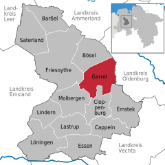  | ||
| Coordinates: 52°57′29″N 8°1′31″E / 52.95806°N 8.02528°ECoordinates: 52°57′29″N 8°1′31″E / 52.95806°N 8.02528°E | ||
| Country | Germany | |
| State | Lower Saxony | |
| District | Cloppenburg | |
| Area | ||
| • Total | 113.23 km2 (43.72 sq mi) | |
| Elevation | 20 m (70 ft) | |
| Population (2017-12-31)[1] | ||
| • Total | 14,918 | |
| • Density | 130/km2 (340/sq mi) | |
| Time zone | CET/CEST (UTC+1/+2) | |
| Postal codes | 49681 | |
| Dialling codes | 04474, 04471 | |
| Vehicle registration | CLP | |
| Website | www.garrel.de | |

Garrel is a municipality in the district of Cloppenburg, in Lower Saxony, Germany. It is situated approximately 15 km north of Cloppenburg, and 25 km southwest of Oldenburg.
Towns and municipalities in Cloppenburg (district) | ||
|---|---|---|
References
This article is issued from
Wikipedia.
The text is licensed under Creative Commons - Attribution - Sharealike.
Additional terms may apply for the media files.