Essen, Lower Saxony
| Essen | ||
|---|---|---|
| ||
 Essen Location of Essen within Cloppenburg district 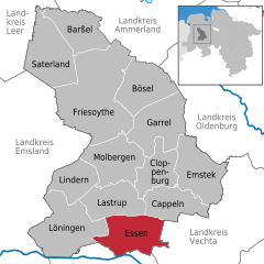  | ||
| Coordinates: 52°43′16″N 7°56′26″E / 52.72111°N 7.94056°ECoordinates: 52°43′16″N 7°56′26″E / 52.72111°N 7.94056°E | ||
| Country | Germany | |
| State | Lower Saxony | |
| District | Cloppenburg | |
| Government | ||
| • Mayor | Georg Kettmann | |
| Area | ||
| • Total | 97.97 km2 (37.83 sq mi) | |
| Elevation | 26.10 m (85.63 ft) | |
| Population (2017-12-31)[1] | ||
| • Total | 8,958 | |
| • Density | 91/km2 (240/sq mi) | |
| Time zone | CET/CEST (UTC+1/+2) | |
| Postal codes | 49632 | |
| Dialling codes | 0 54 34 | |
| Vehicle registration | CLP | |
| Website | essen-oldb.de | |

Essen is a municipality in the district of Cloppenburg, in Lower Saxony, Germany. It is on the river Hase, about 5 km north of Quakenbrück and 15 km southwest of Cloppenburg.
Essen consists of the following parts: Addrup, Ahausen, Barlage, Bartmannsholte, Beverdiek, Bevern, Bokel, Brokstreek, Calhorn, Darrel, Essen-Ort, Felde, Gut Lage, Herbergen, Hülsenmoor, Nordholte, Osteressen, Sandloh and Uptloh.
| Wikimedia Commons has media related to Essen (Oldenburg). |
Towns and municipalities in Cloppenburg (district) | ||
|---|---|---|
References
This article is issued from
Wikipedia.
The text is licensed under Creative Commons - Attribution - Sharealike.
Additional terms may apply for the media files.