Barßel
| Barßel | ||
|---|---|---|
| ||
 Barßel Location of Barßel within Cloppenburg district 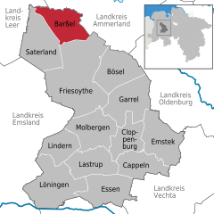  | ||
| Coordinates: 53°10′13″N 07°44′48″E / 53.17028°N 7.74667°ECoordinates: 53°10′13″N 07°44′48″E / 53.17028°N 7.74667°E | ||
| Country | Germany | |
| State | Lower Saxony | |
| District | Cloppenburg | |
| Government | ||
| • Mayor | Bernhard Schulte (Ind.) | |
| Area | ||
| • Total | 84 km2 (32 sq mi) | |
| Elevation | 2 m (7 ft) | |
| Population (2017-12-31)[1] | ||
| • Total | 12,972 | |
| • Density | 150/km2 (400/sq mi) | |
| Time zone | CET/CEST (UTC+1/+2) | |
| Postal codes | 26676 | |
| Dialling codes | 04499 | |
| Vehicle registration | CLP | |
| Website | barssel.de | |

Barßel is a municipality in the district of Cloppenburg, in Lower Saxony, Germany.
Division of the municipality
Barßel consists of 13 districts:
- Barßel
- Barßelermoor
- Carolinenhof
- Elisabethfehn
- Harkebrügge
- Lohe
- Loher-Ostmark
- Loher-Westmark
- Neuland
- Neulohe
- Osterhausen
- Reekenfeld
- Roggenberg
References
External links
- Official website

Towns and municipalities in Cloppenburg (district) | ||
|---|---|---|
| Authority control |
|---|
This article is issued from
Wikipedia.
The text is licensed under Creative Commons - Attribution - Sharealike.
Additional terms may apply for the media files.