Garran, Australian Capital Territory
| Garran Canberra, Australian Capital Territory | |||||||||||||||
|---|---|---|---|---|---|---|---|---|---|---|---|---|---|---|---|
 | |||||||||||||||
| Coordinates | 35°20′31″S 149°06′29″E / 35.342°S 149.108°ECoordinates: 35°20′31″S 149°06′29″E / 35.342°S 149.108°E | ||||||||||||||
| Population | 3,497 (2016 census)[1] | ||||||||||||||
| • Density | 1,295/km2 (3,350/sq mi) | ||||||||||||||
| Established | 1966 | ||||||||||||||
| Postcode(s) | 2605 | ||||||||||||||
| Area | 2.7 km2 (1.0 sq mi) | ||||||||||||||
| District | Woden Valley | ||||||||||||||
| Territory electorate(s) | Murrumbidgee | ||||||||||||||
| Federal Division(s) | Canberra | ||||||||||||||
| |||||||||||||||
Garran is a suburb in the Woden district of Canberra in the Australian Capital Territory. Garran was named after Sir Robert Garran who made numerous contributions to the development of higher education in Canberra. The streets in Garran are named after Australian writers.[2] At the 2016 census, Garran had a population of 3,497 people.[1] The suburb was first settled in 1966 and has an area of 2.74 km².
The Canberra Hospital is located in Garran. The suburb also contains three primary schools: a government school, Garran Primary;[3] a special school for the intellectually disabled, Malkara School[4] and a Catholic school, Sts. Peter & Paul Primary School.[5]
Geology
Garran contains volcanic materials from the Silurian Age. Deakin volcanics purple and green tuff is under the Canberra hospital, around Ingamells Street in the north and the base of Davidson Hill. Deakin Volcanics coarse dark purple rhyodacite is under Fitchett Street and Couvreur Street areas. Deakin Volcanics green grey and purple rhyodacite is in the center and south of Garran.[6]
 |
 |
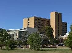 |
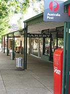
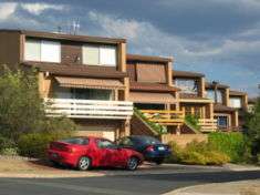
| Garran local shops | 1970s townhouses in Garran | The Canberra Hospital is located in the suburb |
References
- 1 2 Australian Bureau of Statistics (27 June 2017). "Garran (State Suburb)". 2016 Census QuickStats. Retrieved 30 June 2017.

- ↑ "Suburb Name search results". ACT Environment and Sustainable Development. Retrieved 4 February 2014.
- ↑ Garran Primary website
- ↑ Malkara School website
- ↑ Saints Peter and Paul Primary website Archived 2 February 2006 at the Wayback Machine.?
- ↑ Henderson, G. A. M.; Matveev, G. (1980). Geology of Canberra, Queanbeyan and Environs (Map). 1:50000.