Garfield Township, Decatur County, Kansas
| Garfield Township | |
|---|---|
| Township | |
 Location in Decatur County | |
| Coordinates: 39°47′33″N 100°13′11″W / 39.79250°N 100.21972°WCoordinates: 39°47′33″N 100°13′11″W / 39.79250°N 100.21972°W | |
| Country | United States |
| State | Kansas |
| County | Decatur |
| Area | |
| • Total | 35.64 sq mi (92.31 km2) |
| • Land | 35.64 sq mi (92.31 km2) |
| • Water | 0 sq mi (0 km2) 0% |
| Elevation | 2,552 ft (778 m) |
| Population (2000) | |
| • Total | 41 |
| • Density | 1.2/sq mi (0.4/km2) |
| GNIS feature ID | 0471024 |
Garfield Township is a township in Decatur County, Kansas, USA. As of the 2000 census, its population was 41.
Geography
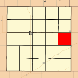
Garfield Township covers an area of 35.64 square miles (92.3 km2) and contains no incorporated settlements. According to the USGS, it contains one cemetery, Clayton.
References
External links
Municipalities and communities of Decatur County, Kansas, United States | ||
|---|---|---|
| Cities | 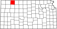 | |
| Unincorporated communities | ||
| Ghost towns | ||
| Townships | ||
| Footnotes | ‡This populated place also has portions in an adjacent county or counties | |
This article is issued from
Wikipedia.
The text is licensed under Creative Commons - Attribution - Sharealike.
Additional terms may apply for the media files.