Gadariya
| Gadariya गदरिया | |
|---|---|
| Village development committee | |
 Gadariya Location in Nepal | |
| Coordinates: 28°39′N 80°46′E / 28.65°N 80.76°ECoordinates: 28°39′N 80°46′E / 28.65°N 80.76°E | |
| Country |
|
| Zone | Seti Zone |
| District | Kailali District |
| Population (1991) | |
| • Total | 7,355 |
| Time zone | UTC+5:45 (Nepal Time) |
Gadariya is a village development committee in Kailali District in the Seti Zone of western Nepal. At the time of the 1991 Nepal census it had a population of 7355 living in 726 individual households.It has a main school named "Shree Janta Higher Secondary school."which is established in 2014 B.S.It has also a beautiful lake which name is Koilahee taal,and it is second biggest lake of Sudurpaschimanchal.[1]
References
- ↑ "Nepal Census 2001", Nepal's Village Development Committees, Digital Himalaya, archived from the original on 12 October 2008, retrieved 15 November 2009 .
External links
Headquarters: Dhangadhi | ||
| Sub-metropolitan cities | 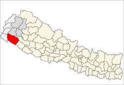 | |
| Municipalities | ||
| Rural municipalities | ||
| Former VDCs | ||
List of municipalities and rural municipalities of Nepal | ||
This article is issued from
Wikipedia.
The text is licensed under Creative Commons - Attribution - Sharealike.
Additional terms may apply for the media files.