Chaumala
| Chaumala (Gauriganga Municipality) चौमाला (गौरीगंगा नगरपालिका) Chaumala | |
|---|---|
| Municipality | |
 Chaumala (Gauriganga Municipality) Location in Nepal | |
| Coordinates: 28°46′N 80°44′E / 28.77°N 80.74°ECoordinates: 28°46′N 80°44′E / 28.77°N 80.74°E | |
| Province |
|
| Province | 7 |
| Zone | Seti Zone |
| District | Kailali District |
| Government | |
| • Mayor | Bhim Bahadur Deuba (NCP) |
| • Deputy Mayor | Anchala Chaudhary (NCP) |
| Area | |
| • Total | 244 km2 (94 sq mi) |
| Population (2011 A.D.) | |
| • Total | 58,286 |
| • Density | 240/km2 (620/sq mi) |
| Time zone | UTC+5:45 (NST) |
| Area code(s) | 091 |
| Website | http://www.gaurigangamun.gov.np |
Chaumala is a Village Development Committee Recently formed into Gauriganga Municipality (गौरीगंगा नगरपालिका) in Kailali District in the Seti Zone of western Nepal, near the town of Dhangadhi. At the time of the 2011 Nepal census it had a population of 58,286 living in 5,293 individual households.Chaumala is exactly located 32 km. east from the primary city and municipality of Kailali district, Dhangadhi and almost 60 km. west from another municipality, Tikapur. It lies across the Mahendra Highway, the only highway of Nepal. It has two small markets, one across the highway itself and other beyond the river.
The village has almost all sort of basic facilities, i.e. education, health, transportation, communication and electricity. There are 9 villages within this VDC; Rajipur, Chaumala, Udashi, Jhil, Mangalpur, Khurkhuriya, Maghi, Banbehada and Kuchaini respectively. It is special because there are inhabitants of almost all the 75 districts of Nepal.[1]
Services
Chaumala is one of the medium business centre of the Kailali District. As a central point for connecting other main cities and villages of the Kailali district, it has the fastest-growing rate of infrastructure and public services. Availability of all infrastructure in Chaumala has driven many people from urban and village areas to migrate to the district.
Transport
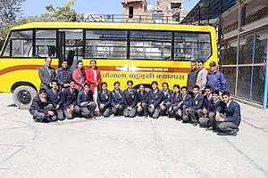
Chaumala is the center of Gauriganga municipality which is gateway of Far west Nepal. The Mahendra Highway making a transport hub in the region. Buses serve as the main mode of transport. Micro van, Tempo, serve as means of local transportation.
Census
Total population of Gauriganga Municipality is 58,286,. Chhetree is the dominant caste followed by Tharu Ethnic group. Brahmin Ranked third with. The male to female sex-ratio is 96.47. Total 5,293 household. [2]
Education
Development of significant number of School and colleges in Chaumala led far western Nepal to become an educational hub. Chaumala Multiple Campus offers various courses on Arts, Commerce and education up to Graduate level. Shree Malika High School is renowned for its quality school level education. The school was awarded by Government of Nepal for its educational excellence.
Health
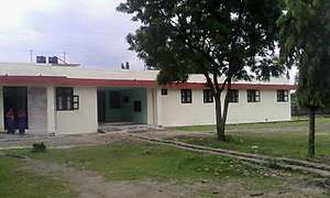
Primary Health Care services based on Chaumala. Primary Health Care Chaumala is a service oriented, social organization that provides various treatment services with community.The number of patients is increasing every year due to continuous improvement in surgical techniques and relatively low service costs of the medical and surgical treatments. These costs are easily affordable for the middle class as
Banking, Finance and Co-operative
- Shree Chaumala Saving & Credit Co-operative Pvt. Ltd.
- Megha Bank Ltd.
- Everest Bank Ltd.
- Janata Bank Ltd.
- Kishan Co-operative Ltd.
- Malika Seving & Credit Co-operative Pvt. Ltd.
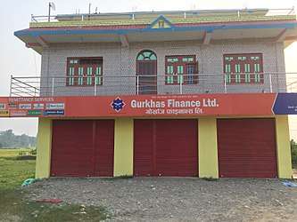
- Gurkhas Finance Ltd.
- Rastriya Banijya Bank Ltd.
- Nepal Rastra Bank Ltd.
Media
- Sunaulo FM
References
- ↑ "Nepal Census 2012". Nepal's Village Development Committees. Digital Himalaya. Archived from the original on 2008-10-12. Retrieved 2008-10-25. .
- ↑ Nepal census 2011
External links
- UN map of the municipalities of Kailali District
- Official website of ddc Kaialali
- City Population - Gauriganga Municipality in Nepal
(Prakash Shah, Sundar Chaudhary, Chaumala)
Headquarters: Dhangadhi | ||
| Sub-metropolitan cities | 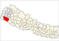 | |
| Municipalities | ||
| Rural municipalities | ||
| Former VDCs | ||
List of municipalities and rural municipalities of Nepal | ||