Fuerte de la Concepción
|
Fuerte de la Concepción[lower-alpha 1] | |
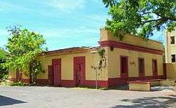 The surviving structure of the fort in 2017 | |
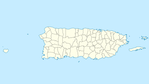 Location of Aguadilla and the Fuerte de la Concepción in Puerto Rico | |
| Location |
Calle Agustín Stahl Aguadilla, Puerto Rico |
|---|---|
| Coordinates | 18°26′09″N 67°09′21″W / 18.435956°N 67.155882°WCoordinates: 18°26′09″N 67°09′21″W / 18.435956°N 67.155882°W |
| Built | 1880 |
| Architect | Spanish Royal Engineers Corps |
| NRHP reference # | 86000703 |
| Added to NRHP | April 3, 1986 |
The Fuerte de la Concepción (English: Fort of the Conception) was a Spanish military fortress guarding the port and town of Aguadilla, Puerto Rico, in the 18th and 19th centuries.[1] In 1986, the fort's single surviving building was listed on the U.S. National Register of Historic Places.[2]
See also
Notes
- ↑ Sources authoritative with regard to National Register listing parameters give different forms of the fort's name, including Fuerte de la Concepción from the fort's nomination form,[1] Fuerte de la Concepcion from the official weekly announcement of National Register actions,[2] and Fuerte de la Conception from the comprehensive National Register database.[3] This article adopts the first of these, Fuerte de la Concepción, because it offers the most proper Spanish orthography.
References
- 1 2 Del Campo, Félix Julián; Acevedo, Joaquín (January 1986), National Register of Historic Places Inventory — Nomination Form: Fuerte de la Concepción (Conception Fort) (PDF), retrieved January 18, 2016 .
- 1 2 National Park Service (April 18, 1986), Weekly announcement of National Register of Historic Places actions (PDF), p. 48, retrieved January 18, 2016 .
- ↑ National Park Service, National Register of Historic Places: NPS Focus, retrieved January 18, 2016 .
External links
- Blog post about the fort (in Spanish)
| Topics | |
|---|---|
| Lists by states |
|
| Lists by insular areas | |
| Lists by associated states | |
| Other areas | |
| |
This article is issued from
Wikipedia.
The text is licensed under Creative Commons - Attribution - Sharealike.
Additional terms may apply for the media files.