Fteri, Pieria
| Fteri Φτέρη | |
|---|---|
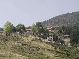 View of Fteri | |
 Fteri | |
| Coordinates: 40°11.7′N 22°8.958′E / 40.1950°N 22.149300°ECoordinates: 40°11.7′N 22°8.958′E / 40.1950°N 22.149300°E | |
| Country | Greece |
| Administrative region | Central Macedonia |
| Regional unit | Pieria |
| Municipality | Katerini |
| Municipal unit | Petra |
| Highest elevation | 1,320 m (4,330 ft) |
| Lowest elevation | 1,200 m (3,900 ft) |
| Population (2011)[1] | |
| • Rural | 16 |
| Time zone | UTC+2 (EET) |
| • Summer (DST) | UTC+3 (EEST) |
| Postal code | 601 00 |
| Area code(s) | +30-2351-xxx-xxx |
| Vehicle registration | KN |
Fteri (Greek: Φτέρη, Aromanian: Fearica) is an Aromanian (Vlach) village of the Katerini municipality.[2] Before the 2011 local government reform it was part of the municipality of Petra, of which it was a municipal district.[2] The 2011 census recorded 16 inhabitants in the village.[1] Fteri is a part of the community of Milia.[1]
See also
References
- 1 2 3 "Απογραφή Πληθυσμού - Κατοικιών 2011. ΜΟΝΙΜΟΣ Πληθυσμός" (in Greek). Hellenic Statistical Authority.
- 1 2 Kallikratis law Greece Ministry of Interior (in Greek)
| Wikimedia Commons has media related to Fteri. |
This article is issued from
Wikipedia.
The text is licensed under Creative Commons - Attribution - Sharealike.
Additional terms may apply for the media files.