Fruitdale, Alabama
| Fruitdale, Alabama | |
|---|---|
| Census-designated place | |
 Location of Fruitdale in Washington County, Alabama. | |
 Fruitdale, Alabama Location of Fruitdale in Washington County, Alabama. | |
| Coordinates: 31°20′34″N 88°24′28″W / 31.34278°N 88.40778°WCoordinates: 31°20′34″N 88°24′28″W / 31.34278°N 88.40778°W | |
| Country | United States |
| State | Alabama |
| County | Washington |
| Area[1] | |
| • Total | 4.49 sq mi (11.63 km2) |
| • Land | 4.47 sq mi (11.59 km2) |
| • Water | 0.02 sq mi (0.04 km2) |
| Elevation | 246 ft (75 m) |
| Population (2010)[2] | |
| • Total | 1,309 |
| • Estimate (2016)[3] | N/A |
| Time zone | UTC-6 (Central (CST)) |
| • Summer (DST) | UTC-5 (CDT) |
| Area code(s) | 251 |
| GNIS feature ID | 118737[4] |
Fruitdale is a census-designated place and unincorporated community in Washington County, Alabama, United States. Its population was 185 as of the 2010 census.[2] Fruitdale High School serves K-12 students in the area.
Demographics
| Historical population | |||
|---|---|---|---|
| Census | Pop. | %± | |
| U.S. Decennial Census[5] | |||
As of the 2010 United States Census, there were 185 people residing in the CDP. The racial makeup of the CDP was 70.3% White, 27.6% Black and 0.5% from two or more races. 1.6% were Hispanic or Latino of any race
References
- ↑ "2016 U.S. Gazetteer Files". United States Census Bureau. Retrieved Jul 17, 2017.
- 1 2 "American FactFinder". United States Census Bureau. Archived from the original on 2013-09-11. Retrieved 2011-05-14.
- ↑ "Population and Housing Unit Estimates". Retrieved June 9, 2017.
- ↑ "Fruitdale". Geographic Names Information System. United States Geological Survey.
- ↑ "Census of Population and Housing". Census.gov. Retrieved June 4, 2016.
Municipalities and communities of Washington County, Alabama, United States | ||
|---|---|---|
| Towns | 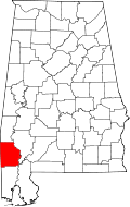 | |
| CDPs | ||
| Unincorporated communities | ||
| Ghost towns | ||
| Footnotes | ‡This populated place also has portions in an adjacent county or counties | |
This article is issued from
Wikipedia.
The text is licensed under Creative Commons - Attribution - Sharealike.
Additional terms may apply for the media files.