Escatawpa, Alabama
| Escatawpa, Alabama | |
|---|---|
| Unincorporated community | |
 Escatawpa, Alabama Location of Escatawpa in Alabama | |
| Coordinates: 31°17′23″N 88°23′14″W / 31.28972°N 88.38722°W | |
| Country | United States |
| State | Alabama |
| County | Washington |
| Elevation | 171 ft (52 m) |
| Time zone | UTC-6 (Central (CST)) |
| • Summer (DST) | UTC-5 (CDT) |
| GNIS feature ID | 118025[1] |
Escatawpa is an unincorporated community in Washington County, Alabama, United States.
History
The community was named after the Escatawpa River.[2] In the Choctaw language, the word "escatawpa" signified a creek where cane was cut, with uski meaning "cane", a meaning "there", and tapa meaning "cut".[3] Escatawpa was located on the Mobile and Ohio Railroad.[4] A post office operated under the name Escatawpa from 1858 to 1953.[5]
In 1909, a traveler from Urbana, Illinois wrote the Champaign-Urbana Courier advising citizens of Urbana to move to the region. He described the area as "a great fruit and vegetable country" and that "fine yellow pine trees are plentiful and Cyprus trees abound".[6]
References
- ↑ "Escatawpa". Geographic Names Information System. United States Geological Survey.
- ↑ Foscue, Virginia (1989). Place Names in Alabama. Tuscaloosa: The University of Alabama Press. p. 53. ISBN 0-8173-0410-X.
- ↑ Read, William A. (1984). Indian Place Names in Alabama. Tuscaloosa: The University of Alabama Press. p. 31. ISBN 0-8173-0231-X.
- ↑ Alabama Public Service Commission (1914). Report. pp. 458–.
- ↑ "Washington County". Jim Forte Postal History. Retrieved 25 December 2014.
- ↑ Gilmir, E. (26 January 1909). "Urbana Man Writes From Sunny Alabama". Champaign-Urbana Courier. Retrieved 26 December 2014.
Municipalities and communities of Washington County, Alabama, United States | ||
|---|---|---|
| Towns | 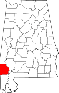 | |
| CDPs | ||
| Unincorporated communities | ||
| Ghost towns | ||
| Footnotes | ‡This populated place also has portions in an adjacent county or counties | |
This article is issued from
Wikipedia.
The text is licensed under Creative Commons - Attribution - Sharealike.
Additional terms may apply for the media files.