Freeman Plat Historic District
|
Freeman Plat Historic District | |
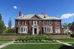 Edwin E. and Martha O. Chase House | |
  | |
| Location | Providence, Rhode Island |
|---|---|
| Coordinates | 41°50′18″N 71°23′39″W / 41.83833°N 71.39417°WCoordinates: 41°50′18″N 71°23′39″W / 41.83833°N 71.39417°W |
| Area | 50 acres (20 ha) |
| Built | 1916 |
| Architect | Olmsted & Olmsted |
| Architectural style | Late 19th And 20th Century Revivals |
| NRHP reference # | 95000664 [1] |
| Added to NRHP | June 2, 1995 |
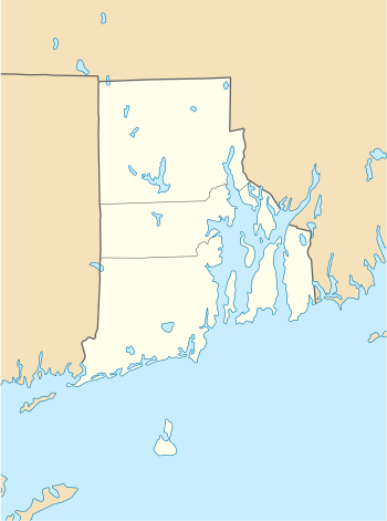
The Freeman Plat Historic District is a residential historic district on the East Side of Providence, Rhode Island. The district is a well-preserved example of an early-20th-century planned residential area, encompassing some 50 acres (20 ha). It is roughly bounded by Sessions Street, Morris Avenue, Laurel Avenue, and Wayland Avenue, and consists of a network of generously-landscaped winding roads, laid out in consultation with the Olmsted Brothers design firm. The houses built are generally of high quality, many of them architect-designed, with architecturally diverse revival styles popular at the time. The area was developed between 1916 and 1929 by John Freeman, who owned a country estate in the area, and sought a way to develop the largely swampy tract.[2]
The district was listed on the National Register of Historic Places in 1995.[1]
See also
References
- 1 2 National Park Service (2007-01-23). "National Register Information System". National Register of Historic Places. National Park Service.
- ↑ "NRHP nomination for Freeman Plat Historic District" (PDF). Rhode Island Preservation. Retrieved 2014-10-12.
| Topics | |
|---|---|
| Lists by states |
|
| Lists by insular areas | |
| Lists by associated states | |
| Other areas | |
| |