Fort Washakie
|
Fort Washakie Historic District | |
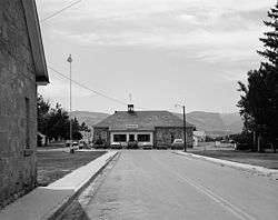 Fort Washakie Building #1 | |
  | |
| Nearest city | Fort Washakie, Wyoming |
|---|---|
| Coordinates | 43°00′23″N 108°52′56″W / 43.00639°N 108.88222°WCoordinates: 43°00′23″N 108°52′56″W / 43.00639°N 108.88222°W |
| Area | 23 acres (9.3 ha) |
| Built | 1869 |
| NRHP reference # | 69000188[1] |
| Added to NRHP | April 16, 1969 |
Fort Washakie was a U.S. Army fort in what is now the U.S. state of Wyoming. The fort was established in 1869 and named Camp Augur after General Christopher C. Augur, commander of the Department of the Platte.[2] In 1870 the camp was renamed Camp Brown in honor of Captain Frederick H. Brown, who was killed in the Fetterman Massacre in 1866.[3]
It was renamed again in 1878 in honor of Chief Washakie of the Shoshone tribe, making the fort the only U.S military outpost named after a Native American. The fort was operated as a military outpost until 1909, when it was decommissioned and turned over to the Shoshone Indian Agency. The graves of Washakie and Lewis and Clark Expedition guide Sacajawea are located on the grounds of the fort. The site is included within the present-day Wind River Indian Reservation.
References
- ↑ National Park Service (2010-07-09). "National Register Information System". National Register of Historic Places. National Park Service.
- ↑ "Camp Augur". wyomingplaces.org.
- ↑ Herbard, Grace Raymond. Marking the Oregon Trail, the Bozeman Road and Historic Places in Wyoming 1908-1920. p. 10.
External links
- Fort Washakie, Building No. 1, Washakie Street, Fort Washakie, Fremont, WY at the Historic American Buildings Survey (HABS)
- Fort Washakie, Building No. 67, Sacajawea Circle, Fort Washakie, Fremont, WY at HABS
- Fort Washakie, Building No. 68, Sacajawea Circle, Fort Washakie, Fremont, WY at HABS
- Fort Washakie, Building No. 69, Sacajawea Circle, Fort Washakie, Fremont, WY at HABS
- Fort Washakie, Building No. 70, Sacajawea Circle, Fort Washakie, Fremont, WY at HABS
- Fort Washakie, Building No. 71, Sacajawea Circle, Fort Washakie, Fremont, WY at HABS
- Fort Washakie, Building No. 72, Sacajawea Circle, Fort Washakie, Fremont, WY at HABS
- Fort Washakie, Building No. 73, Sacajawea Circle, Fort Washakie, Fremont, WY at HABS
- Fort Washakie, Building No. 74, Sacajawea Circle, Fort Washakie, Fremont, WY at HABS