Fort Stamford Site
|
Fort Stamford Site | |
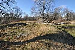 View from atop the earthworks | |
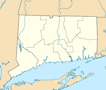  | |
| Location | Stamford, Connecticut |
|---|---|
| Coordinates | 41°5′6″N 73°34′42″W / 41.08500°N 73.57833°WCoordinates: 41°5′6″N 73°34′42″W / 41.08500°N 73.57833°W |
| Area | 5 acres (2.0 ha) |
| Built | 1781 |
| NRHP reference # | 75001920[1] |
| Added to NRHP | September 10, 1975 |
The Fort Stamford Site, site of Fort Stamford, is a public park at 900 Westover Road in Stamford, Connecticut.[2][3] It was listed on the National Register of Historic Places in 1975.[1] It is the site of the archaeological remnants of a military earthworks erected during the American Revolutionary War.[4][5] The fort's location gave a clear view of the Mianus River and Long Island Sound.[6]
The City of Stamford purchased 5-acre property in 1972 from Marcus Goodbody, and the park features some of his garden structures in the formal Goodbody Garden maintained by the Stamford Garden Club.[7]
See also
References
| Wikimedia Commons has media related to Fort Stamford. |
- 1 2 National Park Service (2009-03-13). "National Register Information System". National Register of Historic Places. National Park Service.
- ↑ State Commission on Culture & Tourism list
- ↑ City of Stamford Park List
- ↑ Roberts, Robert B. (1988). Encyclopedia of Historic Forts: The Military, Pioneer, and Trading Posts of the United States. New York: Macmillan. pp. 123–124. ISBN 0-02-926880-X.
- ↑ Fort Stamford at American Forts Network
- ↑ "Fort Stamford haunted by history, and maybe ghosts". Stamford Advocate. October 30, 2014. Retrieved 5 March 2017.
- ↑ "Fort Stamford's Secret Garden". Stamford Patch. May 5, 2011. Retrieved 5 March 2017.
| Topics | |
|---|---|
| Lists by states |
|
| Lists by insular areas | |
| Lists by associated states | |
| Other areas | |
| |
This article is issued from
Wikipedia.
The text is licensed under Creative Commons - Attribution - Sharealike.
Additional terms may apply for the media files.