Fort Santa Agueda
|
Fort Santa Agueda | |
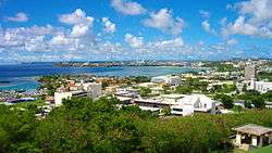 View from the fort | |
 Fort Santa Agueda | |
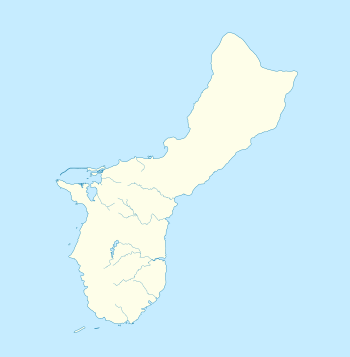
| Location | Guam Highway 7, Hagåtña (Agana), Guam |
|---|---|
| Coordinates | 13°28′25″N 144°44′52″E / 13.47361°N 144.74778°ECoordinates: 13°28′25″N 144°44′52″E / 13.47361°N 144.74778°E |
| Area | 1 acre (0.40 ha) |
| Built | c.1800 |
| NRHP reference # | 74002301[1] |
| Added to NRHP | August 30, 1974 |
Fort Santa Agueda, on Guam Highway 7 in Hagåtña (formerly Agana), Guam, dates from about 1800, during the 1784-1802 administration of Spanish governor Manuel Moro. It was an uncovered fort with a manposteria (coral stone and lime mortar) parapet, rising about 10 feet (3.0 m) above a sloping hillside. It is listed on the U.S. National Register of Historic Places, as the only remaining fortification of the Spanish Era in Hagåtña.[1][2]
The fort was mentioned in 1802 by an officer of an American whaling ship, who recorded that the fort had seven guns and ten men, and that it fired a salute when the governor entered a new church in Agana. Russian Otto von Kotzebue, in 1917, noted that it had only a few guns. It was in ruins by 1887. It was used by Americans as a signal station until 1933, and was converted to a gun emplacement by the Japanese occupiers during World War II.[2]
It became a park in 1960 and was listed on the National Register of Historic Places in 1974.[1][2]
See also
| Wikimedia Commons has media related to Fort Santa Agueda. |
References
- 1 2 3 National Park Service (2010-07-09). "National Register Information System". National Register of Historic Places. National Park Service.
- 1 2 3 David T. Lotz (January 8, 1974). "National Register of Historic Places Inventory/Nomination: Fort Santa Agueda". National Park Service. and accompanying photo from 1973
| Topics | |
|---|---|
| Lists by states |
|
| Lists by insular areas | |
| Lists by associated states | |
| Other areas | |
| |