Fondo, California
Coordinates: 33°06′41″N 115°37′28″W / 33.11139°N 115.62444°W
| Fondo | |
|---|---|
| Unincorporated community | |
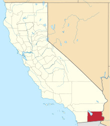
 Fondo Location in California  Fondo Fondo (the US) | |
| Coordinates: 33°06′41″N 115°37′28″W / 33.11139°N 115.62444°W | |
| Country | United States |
| State | California |
| County | Imperial County |
| Elevation[1] | -203 ft (-62 m) |
Fondo is an unincorporated community in Imperial County, California.[1] It is located on the Southern Pacific Railroad 6.5 miles (10 km) west of Calipatria,[2] at an elevation of 203 feet (62 m) below sea level.[1]
References
This article is issued from
Wikipedia.
The text is licensed under Creative Commons - Attribution - Sharealike.
Additional terms may apply for the media files.