Felicity, California
| Felicity | |
|---|---|
| Unincorporated community | |
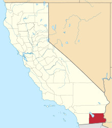
 Felicity Location in California  Felicity Felicity (the US) | |
| Coordinates: 32°45′01″N 114°45′55″W / 32.75028°N 114.76528°WCoordinates: 32°45′01″N 114°45′55″W / 32.75028°N 114.76528°W | |
| Country | United States |
| State | California |
| County | Imperial County |
| Elevation[1] | 285 ft (87 m) |
Felicity is an unincorporated community in Imperial County, California,[1][2] It lies at an elevation of 285 feet (87 m).[1]
Founded on May 11, 1986, the town "Dedicated to Remembrance" was named for his wife by founder Jacques-Andre Istel. It is accessible from Interstate 8 in the far southeast of the state, just west of Yuma, Arizona.
 The pyramid houses the official center point
 Entrance to Center of the World Plaza
References
- 1 2 3 U.S. Geological Survey Geographic Names Information System: Felicity, California
- ↑ "Desert monument captures history on stone". Los Angeles Times. 2008-04-16. Archived from the original on 2008-04-20. Retrieved 2008-04-16.
External links
This article is issued from
Wikipedia.
The text is licensed under Creative Commons - Attribution - Sharealike.
Additional terms may apply for the media files.